

40
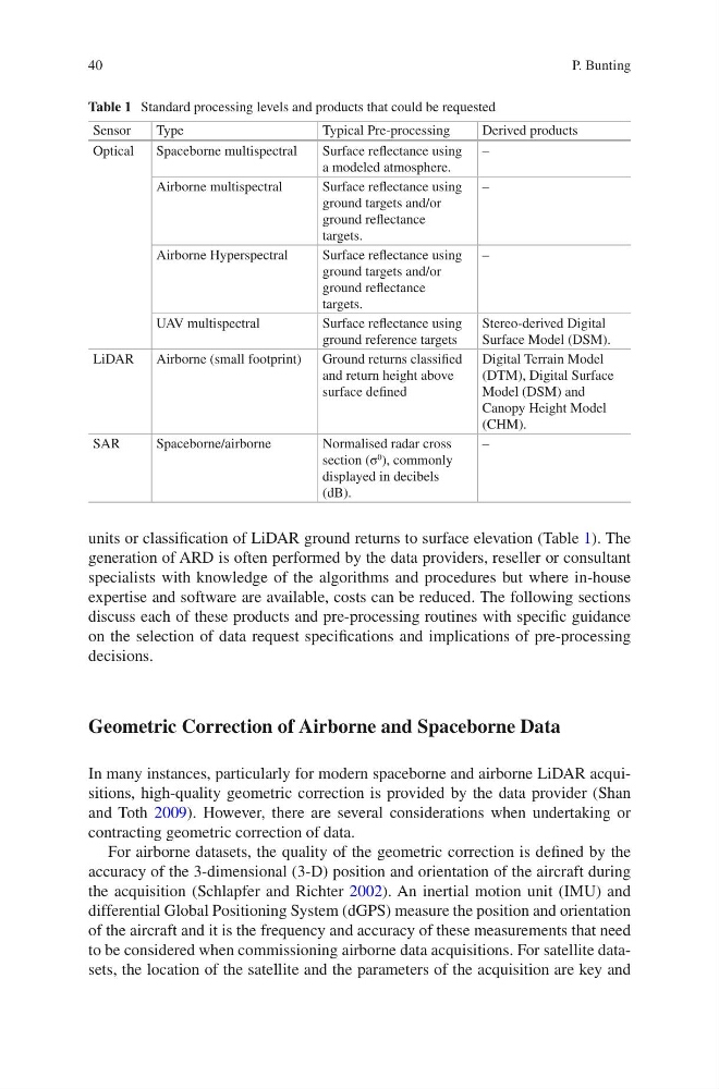
units or classification of LiDAR ground returns to surface elevation (Table 1). The
generation of ARD is often performed by the data providers, reseller or consultant
specialists with knowledge of the algorithms and procedures but where in-house
expertise and software are available, costs can be reduced. The following sections
discuss each of these products and pre-processing routines with specific guidance
on the selection of data request specifications and implications of pre-processing
decisions.
Geometric Correction of Airborne and Spaceborne Data
In many instances, particularly for modern spaceborne and airborne LiDAR acquisitions, high-quality geometric correction is provided by the data provider (Shan
and Toth 2009). However, there are several considerations when undertaking or
contracting geometric correction of data.
For airborne datasets, the quality of the geometric correction is defined by the
accuracy of the 3-dimensional (3-D) position and orientation of the aircraft during
the acquisition (Schlapfer and Richter 2002). An inertial motion unit (IMU) and
differential Global Positioning System (dGPS) measure the position and orientation
of the aircraft and it is the frequency and accuracy of these measurements that need
to be considered when commissioning airborne data acquisitions. For satellite datasets, the location of the satellite and the parameters of the acquisition are key and
Table 1 Standard processing levels and products that could be requested
Sensor
Type
Typical Pre-processing
Derived products
Optical
Spaceborne multispectral
Surface reflectance using
a modeled atmosphere.
–
Airborne multispectral
Surface reflectance using
ground targets and/or
ground reflectance
targets.
–
Airborne Hyperspectral
Surface reflectance using
ground targets and/or
ground reflectance
targets.
–
UAV multispectral
Surface reflectance using
ground reference targets
Stereo-derived Digital
Surface Model (DSM).
LiDAR
Airborne (small footprint)
Ground returns classified
and return height above
surface defined
Digital Terrain Model
(DTM), Digital Surface
Model (DSM) and
Canopy Height Model
(CHM).
SAR
Spaceborne/airborne
Normalised radar cross
section (σ
0 ), commonly
displayed in decibels
(dB).
–
P. Bunting
units or classification of LiDAR ground returns to surface elevation (Table 1). The
generation of ARD is often performed by the data providers, reseller or consultant
specialists with knowledge of the algorithms and procedures but where in-house
expertise and software are available, costs can be reduced. The following sections
discuss each of these products and pre-processing routines with specific guidance
on the selection of data request specifications and implications of pre-processing
decisions.
Geometric Correction of Airborne and Spaceborne Data
In many instances, particularly for modern spaceborne and airborne LiDAR acquisitions, high-quality geometric correction is provided by the data provider (Shan
and Toth 2009). However, there are several considerations when undertaking or
contracting geometric correction of data.
For airborne datasets, the quality of the geometric correction is defined by the
accuracy of the 3-dimensional (3-D) position and orientation of the aircraft during
the acquisition (Schlapfer and Richter 2002). An inertial motion unit (IMU) and
differential Global Positioning System (dGPS) measure the position and orientation
of the aircraft and it is the frequency and accuracy of these measurements that need
to be considered when commissioning airborne data acquisitions. For satellite datasets, the location of the satellite and the parameters of the acquisition are key and
Table 1 Standard processing levels and products that could be requested
Sensor
Type
Typical Pre-processing
Derived products
Optical
Spaceborne multispectral
Surface reflectance using
a modeled atmosphere.
–
Airborne multispectral
Surface reflectance using
ground targets and/or
ground reflectance
targets.
–
Airborne Hyperspectral
Surface reflectance using
ground targets and/or
ground reflectance
targets.
–
UAV multispectral
Surface reflectance using
ground reference targets
Stereo-derived Digital
Surface Model (DSM).
LiDAR
Airborne (small footprint)
Ground returns classified
and return height above
surface defined
Digital Terrain Model
(DTM), Digital Surface
Model (DSM) and
Canopy Height Model
(CHM).
SAR
Spaceborne/airborne
Normalised radar cross
section (σ
0 ), commonly
displayed in decibels
(dB).
–
P. Bunting