

132
from other homogeneous productive grassland types, based upon their height and
adjacency to water.
The Norfolk coastal zone, within which sub-regional mapping took place, was
defined by distance from the sea, height above sea level and the presence of sand
dune features, such as dune slacks. This was achieved using spectral rules together
with ancillary data on elevation. In addition, LiDAR data were used to provide a
structural component for features from the saltmarsh communities. Figure 7
illustrates the additional detail of habitat mapping that was achievable with the
introduction of the higher resolution imagery and LiDAR data.
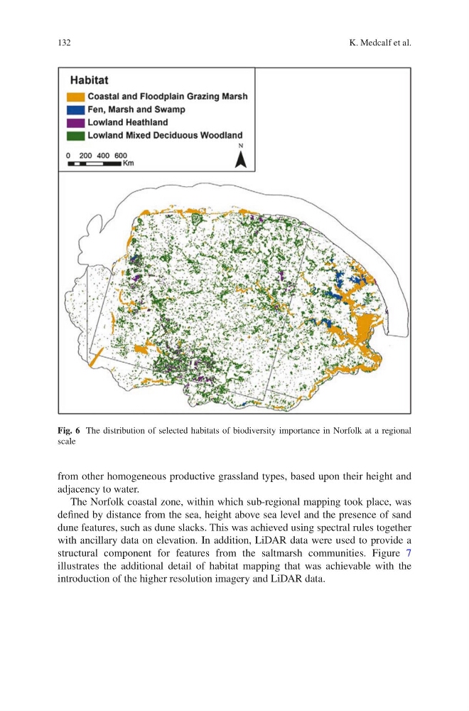
Fig. 6 The distribution of selected habitats of biodiversity importance in Norfolk at a regional
scale
K. Medcalf et al.
from other homogeneous productive grassland types, based upon their height and
adjacency to water.
The Norfolk coastal zone, within which sub-regional mapping took place, was
defined by distance from the sea, height above sea level and the presence of sand
dune features, such as dune slacks. This was achieved using spectral rules together
with ancillary data on elevation. In addition, LiDAR data were used to provide a
structural component for features from the saltmarsh communities. Figure 7
illustrates the additional detail of habitat mapping that was achievable with the
introduction of the higher resolution imagery and LiDAR data.
Fig. 6 The distribution of selected habitats of biodiversity importance in Norfolk at a regional
scale
K. Medcalf et al.