

128
Selecting Imagery for Classification
The number of images needed and the timing of these is driven by the particular
biogeography of the environment. In the example above, a spring image is necessary to separate the coastal grassland types. Other habitats needed a combination of
‘leaf-on’ and ‘leaf-off’ imagery. Norfolk is a diverse and dynamic environment,
where cycles of arable cropping dominate the landscape and factors such as topography can limit the times of year when imagery should be acquired.
One of the key findings of the project was recognition of the effects on the mapping approach arising from differences in the spatial scale at which semi-natural
habitats occur in different parts of the UK. In Wales, where the techniques were first
developed (Lucas et al. 2011), semi-natural habitats can occur in large upland
blocks: mosaics of semi-natural habitats form spatial patterns across whole valley
systems or hillsides. By contrast, in Norfolk, the pressures on the land for arable
use, and the character of the aquifer-fed habitats have resulted in greater fragmentation of semi- natural habitats with these then covering small areas and occurring in
far more intricate mosaics. For this reason, reliable identification of semi-natural
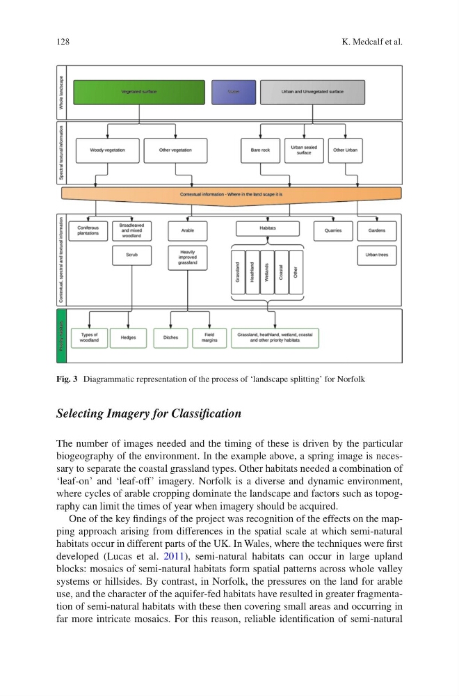
Fig. 3 Diagrammatic representation of the process of ‘landscape splitting’ for Norfolk
K. Medcalf et al.
Selecting Imagery for Classification
The number of images needed and the timing of these is driven by the particular
biogeography of the environment. In the example above, a spring image is necessary to separate the coastal grassland types. Other habitats needed a combination of
‘leaf-on’ and ‘leaf-off’ imagery. Norfolk is a diverse and dynamic environment,
where cycles of arable cropping dominate the landscape and factors such as topography can limit the times of year when imagery should be acquired.
One of the key findings of the project was recognition of the effects on the mapping approach arising from differences in the spatial scale at which semi-natural
habitats occur in different parts of the UK. In Wales, where the techniques were first
developed (Lucas et al. 2011), semi-natural habitats can occur in large upland
blocks: mosaics of semi-natural habitats form spatial patterns across whole valley
systems or hillsides. By contrast, in Norfolk, the pressures on the land for arable
use, and the character of the aquifer-fed habitats have resulted in greater fragmentation of semi- natural habitats with these then covering small areas and occurring in
far more intricate mosaics. For this reason, reliable identification of semi-natural
Fig. 3 Diagrammatic representation of the process of ‘landscape splitting’ for Norfolk
K. Medcalf et al.