

104
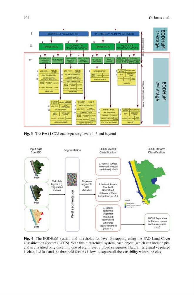
Fig. 4 The EODHaM system and thresholds for level 3 mapping using the FAO Land Cover
Classification System (LCCS). With this hierarchical system, each object (which can include pixels) is classified only once into one of eight level 3 broad categories. Natural terrestrial vegetated
is classified last and the threshold for this is low to capture all the variability within the class
Fig. 3 The FAO LCCS encompassing levels 1–3 and beyond
G. Jones et al.
Fig. 4 The EODHaM system and thresholds for level 3 mapping using the FAO Land Cover
Classification System (LCCS). With this hierarchical system, each object (which can include pixels) is classified only once into one of eight level 3 broad categories. Natural terrestrial vegetated
is classified last and the threshold for this is low to capture all the variability within the class
Fig. 3 The FAO LCCS encompassing levels 1–3 and beyond
G. Jones et al.