

78
Michela Bertolotto
Although this data structure favors progressive transmission, in this case the
reconstruction of intermediate levels on the client site is more complex: the topology
needs be reconstructed.
From a purely graphical point of view, a major requirement for the reconstruction process consists of providing a method for combining a map with increments
into a unique graphical representation. Therefore, the system should allow the addition or elimination of sets of entities from the current display. However, in the case
of progressive transmission, users may be interested in more than a visual inspection
of the data. They may want to analyze and work with a consistent data set. A vector
map is composed not only of a set of points, polylines, and polygons representing
geographical entities, but also of a set of spatial relations linking such entities. Thus,
suitable overlaying and integration techniques must be applied not only at the graphical level, but also at the data level to include the computation of spatial relations
between newly introduced entities and preserved entities.
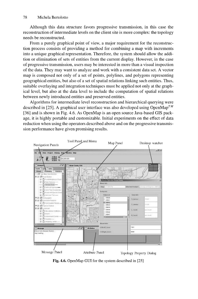
Algorithms for intermediate level reconstruction and hierarchical querying were
described in [25]. A graphical user interface was also developed using OpenMap
T M
[36] and is shown in Fig. 4.6. As OpenMap is an open source Java-based GIS package, it is highly portable and customizable. Initial experiments on the effect of data
reduction when using the operators described above and on the progressive transmission performance have given promising results.
Fig. 4.6. OpenMap GUI for the system described in [25]
Michela Bertolotto
Although this data structure favors progressive transmission, in this case the
reconstruction of intermediate levels on the client site is more complex: the topology
needs be reconstructed.
From a purely graphical point of view, a major requirement for the reconstruction process consists of providing a method for combining a map with increments
into a unique graphical representation. Therefore, the system should allow the addition or elimination of sets of entities from the current display. However, in the case
of progressive transmission, users may be interested in more than a visual inspection
of the data. They may want to analyze and work with a consistent data set. A vector
map is composed not only of a set of points, polylines, and polygons representing
geographical entities, but also of a set of spatial relations linking such entities. Thus,
suitable overlaying and integration techniques must be applied not only at the graphical level, but also at the data level to include the computation of spatial relations
between newly introduced entities and preserved entities.
Algorithms for intermediate level reconstruction and hierarchical querying were
described in [25]. A graphical user interface was also developed using OpenMap
T M
[36] and is shown in Fig. 4.6. As OpenMap is an open source Java-based GIS package, it is highly portable and customizable. Initial experiments on the effect of data
reduction when using the operators described above and on the progressive transmission performance have given promising results.
Fig. 4.6. OpenMap GUI for the system described in [25]