

12 Geographical Data Visualization on Mobile Devices
281
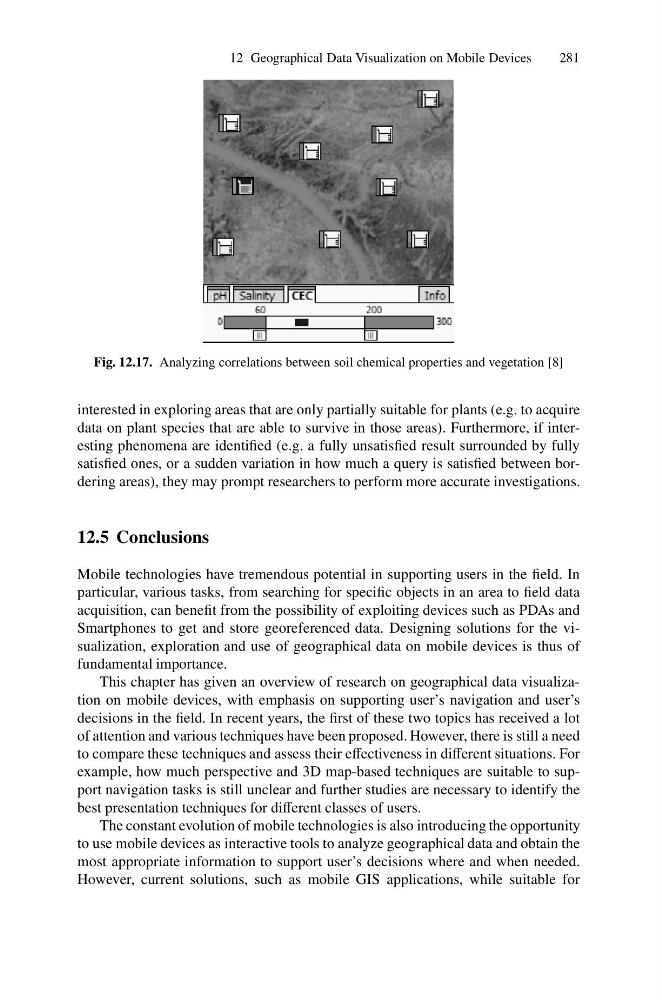
Fig. 12.17. Analyzing correlations between soil chemical properties and vegetation [8]
interested in exploring areas that are only partially suitable for plants (e.g. to acquire
data on plant species that are able to survive in those areas). Furthermore, if interesting phenomena are identified (e.g. a fully unsatisfied result surrounded by fully
satisfied ones, or a sudden variation in how much a query is satisfied between bordering areas), they may prompt researchers to perform more accurate investigations.
12.5 Conclusions
Mobile technologies have tremendous potential in supporting users in the field. In
particular, various tasks, from searching for specific objects in an area to field data
acquisition, can benefit from the possibility of exploiting devices such as PDAs and
Smartphones to get and store georeferenced data. Designing solutions for the visualization, exploration and use of geographical data on mobile devices is thus of
fundamental importance.
This chapter has given an overview of research on geographical data visualization on mobile devices, with emphasis on supporting user’s navigation and user’s
decisions in the field. In recent years, the first of these two topics has received a lot
of attention and various techniques have been proposed. However, there is still a need
to compare these techniques and assess their effectiveness in different situations. For
example, how much perspective and 3D map-based techniques are suitable to support navigation tasks is still unclear and further studies are necessary to identify the
best presentation techniques for different classes of users.
The constant evolution of mobile technologies is also introducing the opportunity
to use mobile devices as interactive tools to analyze geographical data and obtain the
most appropriate information to support user’s decisions where and when needed.
However, current solutions, such as mobile GIS applications, while suitable for
281
Fig. 12.17. Analyzing correlations between soil chemical properties and vegetation [8]
interested in exploring areas that are only partially suitable for plants (e.g. to acquire
data on plant species that are able to survive in those areas). Furthermore, if interesting phenomena are identified (e.g. a fully unsatisfied result surrounded by fully
satisfied ones, or a sudden variation in how much a query is satisfied between bordering areas), they may prompt researchers to perform more accurate investigations.
12.5 Conclusions
Mobile technologies have tremendous potential in supporting users in the field. In
particular, various tasks, from searching for specific objects in an area to field data
acquisition, can benefit from the possibility of exploiting devices such as PDAs and
Smartphones to get and store georeferenced data. Designing solutions for the visualization, exploration and use of geographical data on mobile devices is thus of
fundamental importance.
This chapter has given an overview of research on geographical data visualization on mobile devices, with emphasis on supporting user’s navigation and user’s
decisions in the field. In recent years, the first of these two topics has received a lot
of attention and various techniques have been proposed. However, there is still a need
to compare these techniques and assess their effectiveness in different situations. For
example, how much perspective and 3D map-based techniques are suitable to support navigation tasks is still unclear and further studies are necessary to identify the
best presentation techniques for different classes of users.
The constant evolution of mobile technologies is also introducing the opportunity
to use mobile devices as interactive tools to analyze geographical data and obtain the
most appropriate information to support user’s decisions where and when needed.
However, current solutions, such as mobile GIS applications, while suitable for