

15 Ship Surveillance with High Resolution TerraSAR-X Satellite in African Waters
307
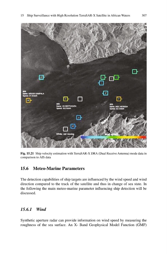
Fig. 15.21 Ship velocity estimation with TerraSAR-X DRA (Dual Receive Antenna) mode data in
comparison to AIS data
15.6 Meteo-Marine Parameters
The detection capabilities of ship targets are influenced by the wind speed and wind
direction compared to the track of the satellite and thus in change of sea state. In
the following the main meteo-marine parameter influencing ship detection will be
discussed.
15.6.1 Wind
Synthetic aperture radar can provide information on wind speed by measuring the
roughness of the sea surface. An X- Band Geophysical Model Function (GMF)
307
Fig. 15.21 Ship velocity estimation with TerraSAR-X DRA (Dual Receive Antenna) mode data in
comparison to AIS data
15.6 Meteo-Marine Parameters
The detection capabilities of ship targets are influenced by the wind speed and wind
direction compared to the track of the satellite and thus in change of sea state. In
the following the main meteo-marine parameter influencing ship detection will be
discussed.
15.6.1 Wind
Synthetic aperture radar can provide information on wind speed by measuring the
roughness of the sea surface. An X- Band Geophysical Model Function (GMF)