

15 Ship Surveillance with High Resolution TerraSAR-X Satellite in African Waters
295
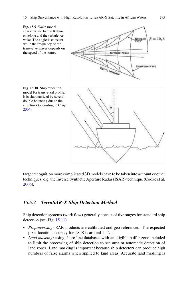
Fig. 15.9 Wake model
characterised by the Kelvin
envelope and the turbulence
wake. The angle is constant
while the frequency of the
transverse waves depends on
the speed of the source
Fig. 15.10 Ship reflection
model for transversal profile.
It is characterized by several
double bouncing due to the
structures (according to Crisp
2004)
target recognition more complicated 3D models have to be taken into account or other
techniques, e.g. the Inverse Synthetic Aperture Radar (ISAR) technique (Cooke et al.
2006).
15.5.2 TerraSAR-X Ship Detection Method
Ship detection systems (work flow) generally consist of five stages for standard ship
detection (see Fig. 15.11):
• Preprocessing: SAR products are calibrated and geo-referenced. The expected
pixel location accuracy for TS-X is around 1−2 m.
• Land masking: using shore-line databases with an eligible buffer zone included
to limit the processing of ship detection to sea area or automatic detection of
land zones. Land masking is important because ship detectors can produce high
numbers of false alarms when applied to land areas. Accurate land masking is
295
Fig. 15.9 Wake model
characterised by the Kelvin
envelope and the turbulence
wake. The angle is constant
while the frequency of the
transverse waves depends on
the speed of the source
Fig. 15.10 Ship reflection
model for transversal profile.
It is characterized by several
double bouncing due to the
structures (according to Crisp
2004)
target recognition more complicated 3D models have to be taken into account or other
techniques, e.g. the Inverse Synthetic Aperture Radar (ISAR) technique (Cooke et al.
2006).
15.5.2 TerraSAR-X Ship Detection Method
Ship detection systems (work flow) generally consist of five stages for standard ship
detection (see Fig. 15.11):
• Preprocessing: SAR products are calibrated and geo-referenced. The expected
pixel location accuracy for TS-X is around 1−2 m.
• Land masking: using shore-line databases with an eligible buffer zone included
to limit the processing of ship detection to sea area or automatic detection of
land zones. Land masking is important because ship detectors can produce high
numbers of false alarms when applied to land areas. Accurate land masking is