

8 Oil Pollution in Coastal Waters of Nigeria
161
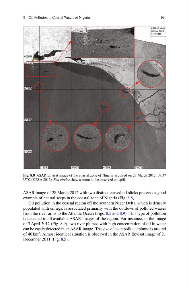
Fig. 8.8 ASAR Envisat image of the coastal zone of Nigeria acquired on 28 March 2012, 09:37
UTC (©ESA 2012). Red circles show a zoom in the observed oil spills
ASAR image of 28 March 2012 with two distinct curved oil slicks presents a good
example of natural seeps in the coastal zone of Nigeria (Fig. 8.8).
Oil pollution in the coastal region off the southern Niger Delta, which is densely
populated with oil rigs, is associated primarily with the outflows of polluted waters
from the river arms to the Atlantic Ocean (Figs. 8.5 and 8.9). This type of pollution
is detected in all available ASAR images of the region. For instance, in the image
of 3 April 2012 (Fig. 8.9), two river plumes with high concentration of oil in water
can be easily detected in an ASAR image. The size of each polluted plume is around
of 40 km
2 . Almost identical situation is observed in the ASAR Envisat image of 21
December 2011 (Fig. 8.5).
161
Fig. 8.8 ASAR Envisat image of the coastal zone of Nigeria acquired on 28 March 2012, 09:37
UTC (©ESA 2012). Red circles show a zoom in the observed oil spills
ASAR image of 28 March 2012 with two distinct curved oil slicks presents a good
example of natural seeps in the coastal zone of Nigeria (Fig. 8.8).
Oil pollution in the coastal region off the southern Niger Delta, which is densely
populated with oil rigs, is associated primarily with the outflows of polluted waters
from the river arms to the Atlantic Ocean (Figs. 8.5 and 8.9). This type of pollution
is detected in all available ASAR images of the region. For instance, in the image
of 3 April 2012 (Fig. 8.9), two river plumes with high concentration of oil in water
can be easily detected in an ASAR image. The size of each polluted plume is around
of 40 km
2 . Almost identical situation is observed in the ASAR Envisat image of 21
December 2011 (Fig. 8.5).