

Two different studies in Greece used Hyperion imagery [63]. For an area north
of Athens, Greece, researchers differentiated several forest types—conifers and
broad-leaved—and identified transitional woodland/scrubland, heterogeneous agricultural areas, scrubland to herbaceous vegetation, sparsely vegetated areas, bare
rocks, urban, burnt areas, and sea [64]. For the island of Crete, researchers differentiated between sparsely vegetated areas, permanent crops, heterogeneous agricultural areas, sclerophyllous vegetation, natural grasslands, bare land, and sea [65].
And, for a specific hydrologic analysis, a study for the Woluwe catchment in
Belgium [66] analyzed CHRIS-Probe imagery [67]. Researchers differentiated
eight land cover classes—forest, agriculture and grassland, water, bare soil, construction site, white buildings, city buildup, and dark buildings. In this study, the
color of man-made objects can affect the accuracy of the land cover classification
schemes and, as such, the resultant hydrologic model. These researchers used the
land cover results as inputs into the WetSpass model to evaluate groundwater
recharge.
6.3 Unmanned Aerial Systems
Unmanned aerial systems (UAS) are lightweight aerial vehicles (both fixed and
rotary winged, commonly called drones) that carry cameras or other imaging
sensors (either passive or active). The vehicles are piloted from a remote location
and, typically, the ground-based pilot uses a wireless link to visually monitor the
imaged area in real time. UAS origins are found from military uses (dating back to
World War I) and from radio-controlled model airplanes used by hobbyists. Images
acquired by UAS are saved on a storage device contained within the airborne
vehicle and then downloaded after landing or streamed live to the remote operator.
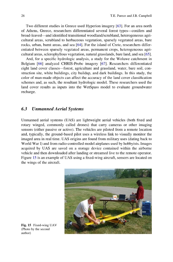
Figure 15 is an example of UAS using a fixed-wing aircraft, sensors are located on
the wings of the aircraft.
Fig. 15 Fixed-wing UAV
(Photo by the second
author)
26
T.E. Parece and J.B. Campbell
of Athens, Greece, researchers differentiated several forest types—conifers and
broad-leaved—and identified transitional woodland/scrubland, heterogeneous agricultural areas, scrubland to herbaceous vegetation, sparsely vegetated areas, bare
rocks, urban, burnt areas, and sea [64]. For the island of Crete, researchers differentiated between sparsely vegetated areas, permanent crops, heterogeneous agricultural areas, sclerophyllous vegetation, natural grasslands, bare land, and sea [65].
And, for a specific hydrologic analysis, a study for the Woluwe catchment in
Belgium [66] analyzed CHRIS-Probe imagery [67]. Researchers differentiated
eight land cover classes—forest, agriculture and grassland, water, bare soil, construction site, white buildings, city buildup, and dark buildings. In this study, the
color of man-made objects can affect the accuracy of the land cover classification
schemes and, as such, the resultant hydrologic model. These researchers used the
land cover results as inputs into the WetSpass model to evaluate groundwater
recharge.
6.3 Unmanned Aerial Systems
Unmanned aerial systems (UAS) are lightweight aerial vehicles (both fixed and
rotary winged, commonly called drones) that carry cameras or other imaging
sensors (either passive or active). The vehicles are piloted from a remote location
and, typically, the ground-based pilot uses a wireless link to visually monitor the
imaged area in real time. UAS origins are found from military uses (dating back to
World War I) and from radio-controlled model airplanes used by hobbyists. Images
acquired by UAS are saved on a storage device contained within the airborne
vehicle and then downloaded after landing or streamed live to the remote operator.
Figure 15 is an example of UAS using a fixed-wing aircraft, sensors are located on
the wings of the aircraft.
Fig. 15 Fixed-wing UAV
(Photo by the second
author)
26
T.E. Parece and J.B. Campbell