

2.3 Real-Time Flow Monitoring
Two examples of real-time water level sensor applications are illustrated below.
The US Geological Survey (USGS) has established a network of real-time water
level monitoring stations on rivers across the United States (Fig. 10). In these
stations, real-time water level is typically recorded at 15- to 60-min intervals
using a combination of the water level sensors described below. Data are stored
on data loggers installed at each station and then transmitted to the USGS offices
every 1–4 h via satellite, telephone, and/or radio telemetry. Typical weekly output
is shown in Fig. 11.
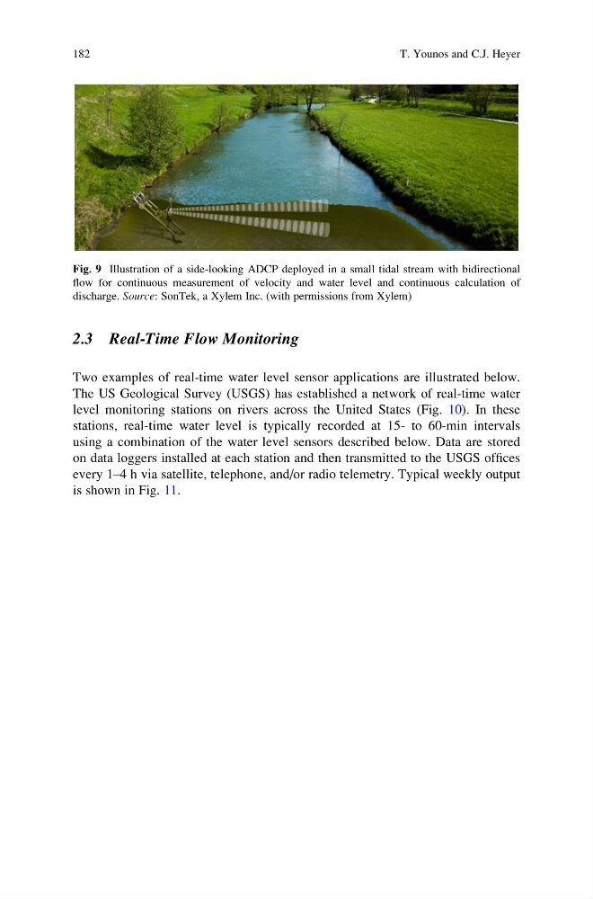
Fig. 9 Illustration of a side-looking ADCP deployed in a small tidal stream with bidirectional
flow for continuous measurement of velocity and water level and continuous calculation of
discharge. Source: SonTek, a Xylem Inc. (with permissions from Xylem)
182
T. Younos and C.J. Heyer
Two examples of real-time water level sensor applications are illustrated below.
The US Geological Survey (USGS) has established a network of real-time water
level monitoring stations on rivers across the United States (Fig. 10). In these
stations, real-time water level is typically recorded at 15- to 60-min intervals
using a combination of the water level sensors described below. Data are stored
on data loggers installed at each station and then transmitted to the USGS offices
every 1–4 h via satellite, telephone, and/or radio telemetry. Typical weekly output
is shown in Fig. 11.
Fig. 9 Illustration of a side-looking ADCP deployed in a small tidal stream with bidirectional
flow for continuous measurement of velocity and water level and continuous calculation of
discharge. Source: SonTek, a Xylem Inc. (with permissions from Xylem)
182
T. Younos and C.J. Heyer