

Return at S
m
i m
¼
X n 1
i 1
. . .
X n mÀ1
i mÀ1
W i 1 Â
Y
mÀ1
p¼1
1 À L
p
i p
À R
p
i p
 C
p pþ1
i p i pþ1
h
i
 R
m
i m
ð6Þ
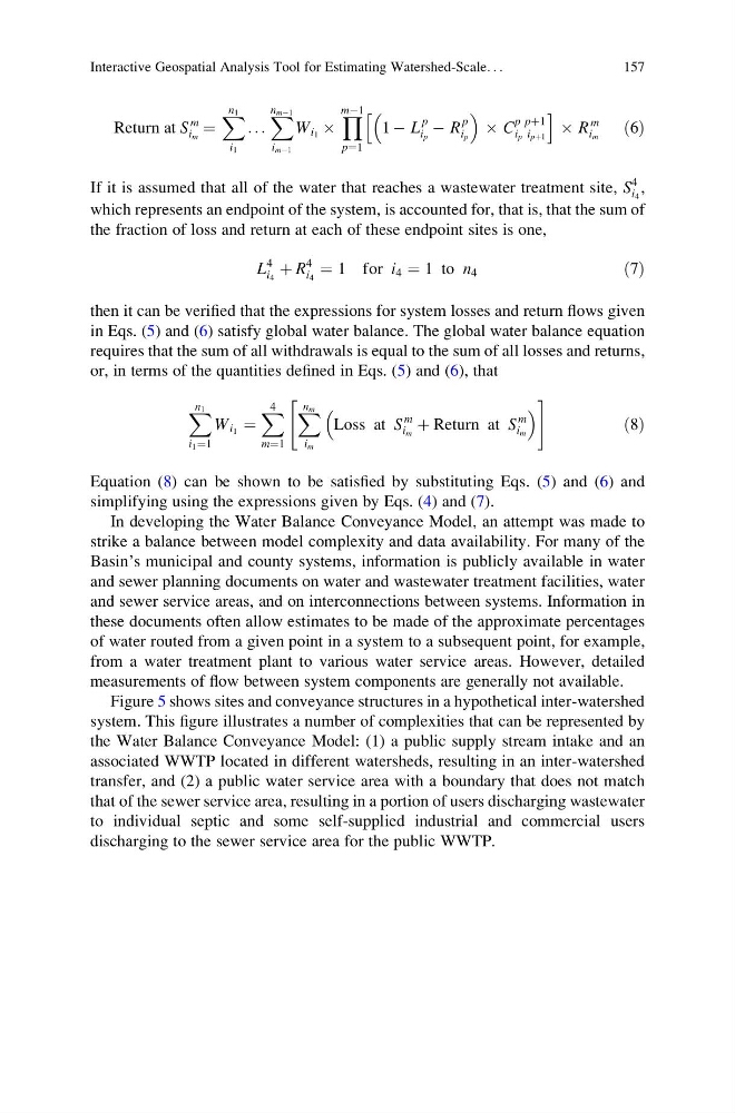
If it is assumed that all of the water that reaches a wastewater treatment site, S
4
i 4
,
which represents an endpoint of the system, is accounted for, that is, that the sum of
the fraction of loss and return at each of these endpoint sites is one,
L
4
i 4
þ R
4
i 4
¼ 1 for i 4 ¼ 1 to n 4
ð7Þ
then it can be verified that the expressions for system losses and return flows given
in Eqs. (5) and (6) satisfy global water balance. The global water balance equation
requires that the sum of all withdrawals is equal to the sum of all losses and returns,
or, in terms of the quantities defined in Eqs. (5) and (6), that
X n 1
i 1 ¼1
W i 1 ¼
X 4
m¼1
X n m
i m
Loss at S
m
i m
þ Return at S
m
i m
"
#
ð8Þ
Equation (8) can be shown to be satisfied by substituting Eqs. (5) and (6) and
simplifying using the expressions given by Eqs. (4) and (7).
In developing the Water Balance Conveyance Model, an attempt was made to
strike a balance between model complexity and data availability. For many of the
Basin’s municipal and county systems, information is publicly available in water
and sewer planning documents on water and wastewater treatment facilities, water
and sewer service areas, and on interconnections between systems. Information in
these documents often allow estimates to be made of the approximate percentages
of water routed from a given point in a system to a subsequent point, for example,
from a water treatment plant to various water service areas. However, detailed
measurements of flow between system components are generally not available.
Figure 5 shows sites and conveyance structures in a hypothetical inter-watershed
system. This figure illustrates a number of complexities that can be represented by
the Water Balance Conveyance Model: (1) a public supply stream intake and an
associated WWTP located in different watersheds, resulting in an inter-watershed
transfer, and (2) a public water service area with a boundary that does not match
that of the sewer service area, resulting in a portion of users discharging wastewater
to individual septic and some self-supplied industrial and commercial users
discharging to the sewer service area for the public WWTP.
Interactive Geospatial Analysis Tool for Estimating Watershed-Scale. . .
157
m
i m
¼
X n 1
i 1
. . .
X n mÀ1
i mÀ1
W i 1 Â
Y
mÀ1
p¼1
1 À L
p
i p
À R
p
i p
 C
p pþ1
i p i pþ1
h
i
 R
m
i m
ð6Þ
If it is assumed that all of the water that reaches a wastewater treatment site, S
4
i 4
,
which represents an endpoint of the system, is accounted for, that is, that the sum of
the fraction of loss and return at each of these endpoint sites is one,
L
4
i 4
þ R
4
i 4
¼ 1 for i 4 ¼ 1 to n 4
ð7Þ
then it can be verified that the expressions for system losses and return flows given
in Eqs. (5) and (6) satisfy global water balance. The global water balance equation
requires that the sum of all withdrawals is equal to the sum of all losses and returns,
or, in terms of the quantities defined in Eqs. (5) and (6), that
X n 1
i 1 ¼1
W i 1 ¼
X 4
m¼1
X n m
i m
Loss at S
m
i m
þ Return at S
m
i m
"
#
ð8Þ
Equation (8) can be shown to be satisfied by substituting Eqs. (5) and (6) and
simplifying using the expressions given by Eqs. (4) and (7).
In developing the Water Balance Conveyance Model, an attempt was made to
strike a balance between model complexity and data availability. For many of the
Basin’s municipal and county systems, information is publicly available in water
and sewer planning documents on water and wastewater treatment facilities, water
and sewer service areas, and on interconnections between systems. Information in
these documents often allow estimates to be made of the approximate percentages
of water routed from a given point in a system to a subsequent point, for example,
from a water treatment plant to various water service areas. However, detailed
measurements of flow between system components are generally not available.
Figure 5 shows sites and conveyance structures in a hypothetical inter-watershed
system. This figure illustrates a number of complexities that can be represented by
the Water Balance Conveyance Model: (1) a public supply stream intake and an
associated WWTP located in different watersheds, resulting in an inter-watershed
transfer, and (2) a public water service area with a boundary that does not match
that of the sewer service area, resulting in a portion of users discharging wastewater
to individual septic and some self-supplied industrial and commercial users
discharging to the sewer service area for the public WWTP.
Interactive Geospatial Analysis Tool for Estimating Watershed-Scale. . .
157