

512
also many deltaic and shoreline marshes and
fl oodplain swamps in the region (Zoltai et al. 1988 ).
23.3.2 Wetland Losses
There had been no signifi cant attempts to summarise the loss of wetlands in Canada as has
been done in case of the wetlands of the USA. It
is mainly because of the vastness of Canada and
its wetlands and also because the low-population regions did not have much signifi cant
impact on wetland loss than the coastal and
southern regions of Canada. Nevertheless, some
estimates do exist for the more populated
regions of Canada. According to some estimates, there had been a loss of c 65 % of coastal
marshes in the Atlantic region, 68 % of all wetlands in southern Ontario and 70 % of the wetlands in the Prairie Pothole Region (Rubec
1994 ). It needs mention here that the most
extensive wetland loss had occurred in southern
Ontario, which is said to be one of the most populated regions in Canada, particularly from
Windsor on the west towards and past Toronto
on the east, where 80 to >90 % wetland loss is
common. Further, studies have shown that c
32 % of the tidal marshes along the St. Lawrence
Estuary had been converted to agricultural use.
Also, on the St. Lawrence River, between
Cornwall and Quebec, there was a loss of c 7 %
in wetland area from 1950 to 1978 alone
(National Wetland Working Group 1988 ).
23.3.3 Some Wetlands of Canada
There are many wetlands in Canada. An account
of some of the lentic bodies in Canada is given
below.
23.3.3.1 Leitrim Wetlands
The Leitrim Wetlands (also known as Albion
Road Wetlands ) is a large provincially signifi cant
bog near the village of Leitrim in the city of
Ottawa. It has been a long-standing issue for
environmental organisations in the city to protect
it from human intervention.
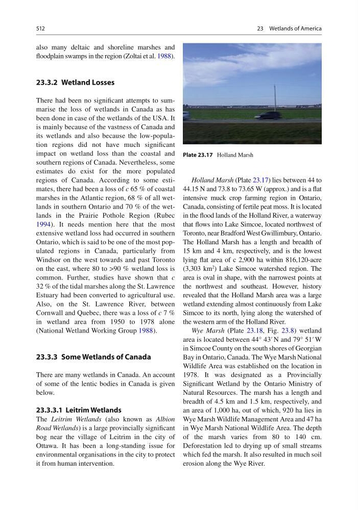
Holland Marsh (Plate 23.17 ) lies between 44 to
44.15 N and 73.8 to 73.65 W (approx.) and is a fl at
intensive muck crop farming region in Ontario,
Canada, consisting of fertile peat moss. It is located
in the fl ood lands of the Holland River, a waterway
that fl ows into Lake Simcoe, located northwest of
Toronto, near Bradford West Gwillimbury, Ontario.
The Holland Marsh has a length and breadth of
15 km and 4 km, respectively, and is the lowest
lying fl at area of c 2,900 ha within 816,120-acre
(3,303 km
2
) Lake Simcoe watershed region. The
area is oval in shape, with the narrowest points at
the northwest and southeast. However, history
revealed that the Holland Marsh area was a large
wetland extending almost continuously from Lake
Simcoe to its north, lying along the watershed of
the western arm of the Holland River.
Wye Marsh (Plate 23.18 , Fig. 23.8 ) wetland
area is located between 44° 43′ N and 79° 51′ W
in Simcoe County on the south shores of Georgian
Bay in Ontario, Canada. The Wye Marsh National
Wildlife Area was established on the location in
1978. It was designated as a Provincially
Signifi cant Wetland by the Ontario Ministry of
Natural Resources. The marsh has a length and
breadth of 4.5 km and 1.5 km, respectively, and
an area of 1,000 ha, out of which, 920 ha lies in
Wye Marsh Wildlife Management Area and 47 ha
in Wye Marsh National Wildlife Area. The depth
of the marsh varies from 80 to 140 cm.
Deforestation led to drying up of small streams
which fed the marsh. It also resulted in much soil
erosion along the Wye River.
Plate 23.17 Holland Marsh
23 Wetlands of America
also many deltaic and shoreline marshes and
fl oodplain swamps in the region (Zoltai et al. 1988 ).
23.3.2 Wetland Losses
There had been no signifi cant attempts to summarise the loss of wetlands in Canada as has
been done in case of the wetlands of the USA. It
is mainly because of the vastness of Canada and
its wetlands and also because the low-population regions did not have much signifi cant
impact on wetland loss than the coastal and
southern regions of Canada. Nevertheless, some
estimates do exist for the more populated
regions of Canada. According to some estimates, there had been a loss of c 65 % of coastal
marshes in the Atlantic region, 68 % of all wetlands in southern Ontario and 70 % of the wetlands in the Prairie Pothole Region (Rubec
1994 ). It needs mention here that the most
extensive wetland loss had occurred in southern
Ontario, which is said to be one of the most populated regions in Canada, particularly from
Windsor on the west towards and past Toronto
on the east, where 80 to >90 % wetland loss is
common. Further, studies have shown that c
32 % of the tidal marshes along the St. Lawrence
Estuary had been converted to agricultural use.
Also, on the St. Lawrence River, between
Cornwall and Quebec, there was a loss of c 7 %
in wetland area from 1950 to 1978 alone
(National Wetland Working Group 1988 ).
23.3.3 Some Wetlands of Canada
There are many wetlands in Canada. An account
of some of the lentic bodies in Canada is given
below.
23.3.3.1 Leitrim Wetlands
The Leitrim Wetlands (also known as Albion
Road Wetlands ) is a large provincially signifi cant
bog near the village of Leitrim in the city of
Ottawa. It has been a long-standing issue for
environmental organisations in the city to protect
it from human intervention.
Holland Marsh (Plate 23.17 ) lies between 44 to
44.15 N and 73.8 to 73.65 W (approx.) and is a fl at
intensive muck crop farming region in Ontario,
Canada, consisting of fertile peat moss. It is located
in the fl ood lands of the Holland River, a waterway
that fl ows into Lake Simcoe, located northwest of
Toronto, near Bradford West Gwillimbury, Ontario.
The Holland Marsh has a length and breadth of
15 km and 4 km, respectively, and is the lowest
lying fl at area of c 2,900 ha within 816,120-acre
(3,303 km
2
) Lake Simcoe watershed region. The
area is oval in shape, with the narrowest points at
the northwest and southeast. However, history
revealed that the Holland Marsh area was a large
wetland extending almost continuously from Lake
Simcoe to its north, lying along the watershed of
the western arm of the Holland River.
Wye Marsh (Plate 23.18 , Fig. 23.8 ) wetland
area is located between 44° 43′ N and 79° 51′ W
in Simcoe County on the south shores of Georgian
Bay in Ontario, Canada. The Wye Marsh National
Wildlife Area was established on the location in
1978. It was designated as a Provincially
Signifi cant Wetland by the Ontario Ministry of
Natural Resources. The marsh has a length and
breadth of 4.5 km and 1.5 km, respectively, and
an area of 1,000 ha, out of which, 920 ha lies in
Wye Marsh Wildlife Management Area and 47 ha
in Wye Marsh National Wildlife Area. The depth
of the marsh varies from 80 to 140 cm.
Deforestation led to drying up of small streams
which fed the marsh. It also resulted in much soil
erosion along the Wye River.
Plate 23.17 Holland Marsh
23 Wetlands of America