

499
also suggest that when these gradients do occur,
they rapidly degenerate at night or under slight
wind stress. Since many Florida lakes are relatively shallow (mean depth <5 m) and topography
obstructs little obstruction to wind action, it is
believed that the holomictic condition observed
in Lake Kissimmee may be typical of the state’s
lakes, particularly, those in the central portion of
the peninsula.
23.2.1.4 Wetlands of Georgia State
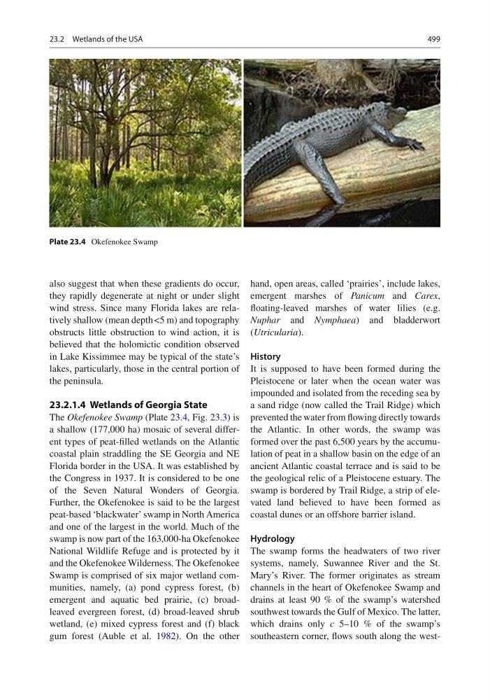
The Okefenokee Swamp (Plate 23.4 , Fig. 23.3 ) is
a shallow (177,000 ha) mosaic of several different types of peat-fi lled wetlands on the Atlantic
coastal plain straddling the SE Georgia and NE
Florida border in the USA. It was established by
the Congress in 1937. It is considered to be one
of the Seven Natural Wonders of Georgia.
Further, the Okefenokee is said to be the largest
peat-based ‘blackwater’ swamp in North America
and one of the largest in the world. Much of the
swamp is now part of the 163,000-ha Okefenokee
National Wildlife Refuge and is protected by it
and the Okefenokee Wilderness. The Okefenokee
Swamp is comprised of six major wetland communities, namely, (a) pond cypress forest, (b)
emergent and aquatic bed prairie, (c) broadleaved evergreen forest, (d) broad-leaved shrub
wetland, (e) mixed cypress forest and (f) black
gum forest (Auble et al. 1982 ). On the other
hand, open areas, called ‘prairies’, include lakes,
emergent marshes of Panicum and Carex ,
fl oating- leaved marshes of water lilies (e.g.
Nuphar and Nymphaea ) and bladderwort
( Utricularia ).
History
It is supposed to have been formed during the
Pleistocene or later when the ocean water was
impounded and isolated from the receding sea by
a sand ridge (now called the Trail Ridge) which
prevented the water from fl owing directly towards
the Atlantic. In other words, the swamp was
formed over the past 6,500 years by the accumulation of peat in a shallow basin on the edge of an
ancient Atlantic coastal terrace and is said to be
the geological relic of a Pleistocene estuary. The
swamp is bordered by Trail Ridge, a strip of elevated land believed to have been formed as
coastal dunes or an offshore barrier island.
Hydrology
The swamp forms the headwaters of two river
systems, namely, Suwannee River and the St.
Mary’s River. The former originates as stream
channels in the heart of Okefenokee Swamp and
drains at least 90 % of the swamp’s watershed
southwest towards the Gulf of Mexico. The latter,
which drains only c 5–10 % of the swamp’s
southeastern corner, fl ows south along the westPlate 23.4 Okefenokee Swamp
23.2 Wetlands of the USA
also suggest that when these gradients do occur,
they rapidly degenerate at night or under slight
wind stress. Since many Florida lakes are relatively shallow (mean depth <5 m) and topography
obstructs little obstruction to wind action, it is
believed that the holomictic condition observed
in Lake Kissimmee may be typical of the state’s
lakes, particularly, those in the central portion of
the peninsula.
23.2.1.4 Wetlands of Georgia State
The Okefenokee Swamp (Plate 23.4 , Fig. 23.3 ) is
a shallow (177,000 ha) mosaic of several different types of peat-fi lled wetlands on the Atlantic
coastal plain straddling the SE Georgia and NE
Florida border in the USA. It was established by
the Congress in 1937. It is considered to be one
of the Seven Natural Wonders of Georgia.
Further, the Okefenokee is said to be the largest
peat-based ‘blackwater’ swamp in North America
and one of the largest in the world. Much of the
swamp is now part of the 163,000-ha Okefenokee
National Wildlife Refuge and is protected by it
and the Okefenokee Wilderness. The Okefenokee
Swamp is comprised of six major wetland communities, namely, (a) pond cypress forest, (b)
emergent and aquatic bed prairie, (c) broadleaved evergreen forest, (d) broad-leaved shrub
wetland, (e) mixed cypress forest and (f) black
gum forest (Auble et al. 1982 ). On the other
hand, open areas, called ‘prairies’, include lakes,
emergent marshes of Panicum and Carex ,
fl oating- leaved marshes of water lilies (e.g.
Nuphar and Nymphaea ) and bladderwort
( Utricularia ).
History
It is supposed to have been formed during the
Pleistocene or later when the ocean water was
impounded and isolated from the receding sea by
a sand ridge (now called the Trail Ridge) which
prevented the water from fl owing directly towards
the Atlantic. In other words, the swamp was
formed over the past 6,500 years by the accumulation of peat in a shallow basin on the edge of an
ancient Atlantic coastal terrace and is said to be
the geological relic of a Pleistocene estuary. The
swamp is bordered by Trail Ridge, a strip of elevated land believed to have been formed as
coastal dunes or an offshore barrier island.
Hydrology
The swamp forms the headwaters of two river
systems, namely, Suwannee River and the St.
Mary’s River. The former originates as stream
channels in the heart of Okefenokee Swamp and
drains at least 90 % of the swamp’s watershed
southwest towards the Gulf of Mexico. The latter,
which drains only c 5–10 % of the swamp’s
southeastern corner, fl ows south along the westPlate 23.4 Okefenokee Swamp
23.2 Wetlands of the USA