

496
in data. There had also been signifi cant drainage
of wetlands which occurred since the early
estimates were made at the beginning of the
century.
23.2.1 State-by-State Distribution
of Wetlands in the USA
There had been >80 % losses of wetlands in the
mid-western USA (Illinois, Indianan, Iowa,
Kentucky, Missouri and Ohio) including California.
Further, it may be noted here that, collectively,
seven states in the Mississippi River basin
(Indiana, Illinois, Iowa, Minnesota, Missouri,
Ohio and Wisconsin) have had about 18.5 million
ha of land artifi cially drained mainly for agricultural production (Zucker and Brown 1998 ). These
states collectively show a loss of 14.1 million ha
of wetlands during the past 200 years. Minnesota,
Illinois, Louisiana and Florida are the states with
high densities of wetlands. They had depicted
the highest losses of total area of wetlands,
namely, 2.6, 2.8, 3.0 and 3.8 million ha, respectively. It is important to note here that the
wetland estimates of the USA change the national
numbers altogether if Alaska is included. It had
been estimated that there is 69 million ha of wetlands in Alaska alone, which is more than the
total estimate for the lower 48 states of the USA
(42 million ha).
23.2.1.1 Wetlands of Alaska State
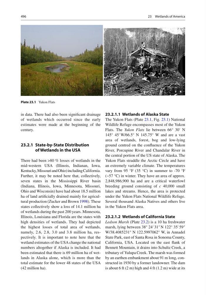
The Yukon Flats (Plate 23.1 , Fig. 23.1 ) National
Wildlife Refuge encompasses most of the Yukon
Flats. The Yukon Flats lie between 66° 30′ N
145° 45′ W/66.5° N 145.75° W and are a vast
area of wetlands, forest, bog and low-lying
ground centred on the confl uence of the Yukon
River, Porcupine River and Chandalar River in
the central portion of the US state of Alaska. The
Yukon Flats straddle the Arctic Circle and have
an extremely variable climate. The temperatures
vary from 95 °F (35 °C) in summer to -70 °F
(−57 °C) in winter. They have an area of approx.
2,848,986,900 ha and are a critical waterfowl
breeding ground consisting of c 40,000 small
lakes and streams. Hence, the area is protected
under the Yukon Flats National Wildlife Refuge.
Several thousand Alaska Natives and others live
in the Yukon Flats area.
23.2.1.2 Wetlands of California State
Ledson Marsh (Plate 23.2 ) is a 10 ha freshwater
marsh, lying between 38° 24′ 31″ N 122° 35′ 59″
W/38.4085231° N 122.5997062° W, in Annadel
State Park, east of Santa Rosa in Sonoma County,
California, USA. Located on the east fl ank of
Bennett Mountain, it drains into Schultz Creek, a
tributary of Yulupa Creek. The marsh was formed
by an earthen embankment about 91 m long, constructed in 1930 by a former landowner. The dam
is about 6 ft (2 m) high and 4 ft (1.2 m) wide at its
Plate 23.1 Yukon Flats
23 Wetlands of America
in data. There had also been signifi cant drainage
of wetlands which occurred since the early
estimates were made at the beginning of the
century.
23.2.1 State-by-State Distribution
of Wetlands in the USA
There had been >80 % losses of wetlands in the
mid-western USA (Illinois, Indianan, Iowa,
Kentucky, Missouri and Ohio) including California.
Further, it may be noted here that, collectively,
seven states in the Mississippi River basin
(Indiana, Illinois, Iowa, Minnesota, Missouri,
Ohio and Wisconsin) have had about 18.5 million
ha of land artifi cially drained mainly for agricultural production (Zucker and Brown 1998 ). These
states collectively show a loss of 14.1 million ha
of wetlands during the past 200 years. Minnesota,
Illinois, Louisiana and Florida are the states with
high densities of wetlands. They had depicted
the highest losses of total area of wetlands,
namely, 2.6, 2.8, 3.0 and 3.8 million ha, respectively. It is important to note here that the
wetland estimates of the USA change the national
numbers altogether if Alaska is included. It had
been estimated that there is 69 million ha of wetlands in Alaska alone, which is more than the
total estimate for the lower 48 states of the USA
(42 million ha).
23.2.1.1 Wetlands of Alaska State
The Yukon Flats (Plate 23.1 , Fig. 23.1 ) National
Wildlife Refuge encompasses most of the Yukon
Flats. The Yukon Flats lie between 66° 30′ N
145° 45′ W/66.5° N 145.75° W and are a vast
area of wetlands, forest, bog and low-lying
ground centred on the confl uence of the Yukon
River, Porcupine River and Chandalar River in
the central portion of the US state of Alaska. The
Yukon Flats straddle the Arctic Circle and have
an extremely variable climate. The temperatures
vary from 95 °F (35 °C) in summer to -70 °F
(−57 °C) in winter. They have an area of approx.
2,848,986,900 ha and are a critical waterfowl
breeding ground consisting of c 40,000 small
lakes and streams. Hence, the area is protected
under the Yukon Flats National Wildlife Refuge.
Several thousand Alaska Natives and others live
in the Yukon Flats area.
23.2.1.2 Wetlands of California State
Ledson Marsh (Plate 23.2 ) is a 10 ha freshwater
marsh, lying between 38° 24′ 31″ N 122° 35′ 59″
W/38.4085231° N 122.5997062° W, in Annadel
State Park, east of Santa Rosa in Sonoma County,
California, USA. Located on the east fl ank of
Bennett Mountain, it drains into Schultz Creek, a
tributary of Yulupa Creek. The marsh was formed
by an earthen embankment about 91 m long, constructed in 1930 by a former landowner. The dam
is about 6 ft (2 m) high and 4 ft (1.2 m) wide at its
Plate 23.1 Yukon Flats
23 Wetlands of America