

481
and the two arms of the River Rhône delta. The
eastern arm is called the Grand Rhône ; while the
western one is the Petit Rhône . Administratively,
it lies within the département of Bouches-duRhône, appropriately named ‘Mouths of the
Rhône’. A further expanse of marshy plain, the
Petite Camargue (little Camargue), just to the
west of the Petit Rhône , is in the département of
Gard. Offi cially established as a regional park
and nature reserve in 1970, the Parc Naturel
Régional de Camargue covers 820 km
2
(82,000 ha) that are some of the wildest and
most protected in all of Europe. The area was
also the inspiration for naming Operation
Camargue during the First Indochina War.
Camargue was designated as a ‘Wetland of
International Importance’ under the Ramsar
Convention on 01 December 1986.
22.6.2 Geography
With an area of >930 km
2 (93,000 ha or 360
miles
2 ), the Camargue is western Europe’s largest
river delta. It is a vast plain comprising of large
brine lagoons or étangs , cut off from the sea by
sandbars and encircled by reed-covered marshes.
These are, in turn, surrounded by a large cultivated area. Approx. a third of the Camargue is
either lakes or marshlands. The central area
around the shoreline of the Étang de Vaccarès
has been protected as a regional park since 1927,
in recognition of its great importance as a haven
for wild birds. In 2008, it was incorporated into
the larger ‘Parc naturel régional de Camargue’.
22.6.2.1 Flora and Fauna
The Camargue is home to >400 species of birds.
Its brine ponds provide one of the few European
habitats for the greater fl amingos. The marshes
are also a prime habitat for many species of
insects, notably some of the most ferocious
mosquitoes to be found anywhere in France.
The fl ora of the Camargue is specially
adapted to cope with the saline conditions. Sea
lavender and glasswort fl ourish, along with tamarisks and reeds.
22.6.2.2 Human Infl uence
Human beings have lived in the Camargue for
millennia, greatly affecting it with drainage
schemes, dykes, rice paddies and salt pans. Much
of the outer Camargue has been drained for
agricultural purposes. The main crops are cereals, grapevine and rice. Near the seashore, prehistoric man started extracting salt, a practice that
continued.
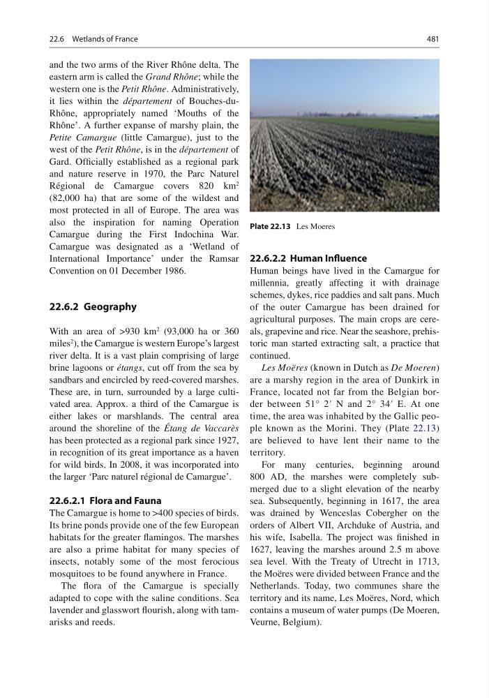
Les Moëres (known in Dutch as De Moeren )
are a marshy region in the area of Dunkirk in
France, located not far from the Belgian border between 51° 2′ N and 2° 34′ E. At one
time, the area was inhabited by the Gallic people known as the Morini. They (Plate 22.13 )
are believed to have lent their name to the
territory.
For many centuries, beginning around
800 AD, the marshes were completely submerged due to a slight elevation of the nearby
sea. Subsequently, beginning in 1617, the area
was drained by Wenceslas Cobergher on the
orders of Albert VII, Archduke of Austria, and
his wife, Isabella. The project was fi nished in
1627, leaving the marshes around 2.5 m above
sea level. With the Treaty of Utrecht in 1713,
the Moëres were divided between France and the
Netherlands. Today , two communes share the
territory and its name, Les Moëres, Nord, which
contains a museum of water pumps (De Moeren,
Veurne, Belgium).
Plate 22.13 Les Moeres
22.6 Wetlands of France
and the two arms of the River Rhône delta. The
eastern arm is called the Grand Rhône ; while the
western one is the Petit Rhône . Administratively,
it lies within the département of Bouches-duRhône, appropriately named ‘Mouths of the
Rhône’. A further expanse of marshy plain, the
Petite Camargue (little Camargue), just to the
west of the Petit Rhône , is in the département of
Gard. Offi cially established as a regional park
and nature reserve in 1970, the Parc Naturel
Régional de Camargue covers 820 km
2
(82,000 ha) that are some of the wildest and
most protected in all of Europe. The area was
also the inspiration for naming Operation
Camargue during the First Indochina War.
Camargue was designated as a ‘Wetland of
International Importance’ under the Ramsar
Convention on 01 December 1986.
22.6.2 Geography
With an area of >930 km
2 (93,000 ha or 360
miles
2 ), the Camargue is western Europe’s largest
river delta. It is a vast plain comprising of large
brine lagoons or étangs , cut off from the sea by
sandbars and encircled by reed-covered marshes.
These are, in turn, surrounded by a large cultivated area. Approx. a third of the Camargue is
either lakes or marshlands. The central area
around the shoreline of the Étang de Vaccarès
has been protected as a regional park since 1927,
in recognition of its great importance as a haven
for wild birds. In 2008, it was incorporated into
the larger ‘Parc naturel régional de Camargue’.
22.6.2.1 Flora and Fauna
The Camargue is home to >400 species of birds.
Its brine ponds provide one of the few European
habitats for the greater fl amingos. The marshes
are also a prime habitat for many species of
insects, notably some of the most ferocious
mosquitoes to be found anywhere in France.
The fl ora of the Camargue is specially
adapted to cope with the saline conditions. Sea
lavender and glasswort fl ourish, along with tamarisks and reeds.
22.6.2.2 Human Infl uence
Human beings have lived in the Camargue for
millennia, greatly affecting it with drainage
schemes, dykes, rice paddies and salt pans. Much
of the outer Camargue has been drained for
agricultural purposes. The main crops are cereals, grapevine and rice. Near the seashore, prehistoric man started extracting salt, a practice that
continued.
Les Moëres (known in Dutch as De Moeren )
are a marshy region in the area of Dunkirk in
France, located not far from the Belgian border between 51° 2′ N and 2° 34′ E. At one
time, the area was inhabited by the Gallic people known as the Morini. They (Plate 22.13 )
are believed to have lent their name to the
territory.
For many centuries, beginning around
800 AD, the marshes were completely submerged due to a slight elevation of the nearby
sea. Subsequently, beginning in 1617, the area
was drained by Wenceslas Cobergher on the
orders of Albert VII, Archduke of Austria, and
his wife, Isabella. The project was fi nished in
1627, leaving the marshes around 2.5 m above
sea level. With the Treaty of Utrecht in 1713,
the Moëres were divided between France and the
Netherlands. Today , two communes share the
territory and its name, Les Moëres, Nord, which
contains a museum of water pumps (De Moeren,
Veurne, Belgium).
Plate 22.13 Les Moeres
22.6 Wetlands of France