

388
Vishansar, Gangabal, Kishna Sar, Kyo Tso and
Pangong Tso, which have, probably, originated
during the third Himalayan glaciation. The highest lake is said to be situated at 5,297 m MSL.
20.3.6.1 A Typical Kashmir Himalayan
Lake
The primary production, measured by in situ 14 C
isotope technique, was found to range from 36 to
906 mg/cm/day with characteristic seasonal variations. The photosynthetic effi ciency ranged from
0.02 to 0.48 % during the same period. The annual
production was estimated at 134 g/cm, which
shows that the lake has not yet reached a high
level of eutrophication. The waterbody has been
classifi ed as mesotrophic (Khan and Zutshi 1980 ).
Further details of the lentic bodies of J and K
have been dealt with in Chap. 6 .
20.3.7 Wetlands of Karnataka
The province of Karnataka, situated between 11°
31′ and 18° 45′ N and 74° 12′ and 78° 40′ E, is
blessed with many wetlands, rivers, etc. There is
also negligible quantity of rainfall during summer and winter. Temperature is lowest in early
January, increasing gradually after mid-February
to early March. The warmest month in major
parts of the State is May when maximum temperature may be 43 °C.
20.3.7.1 Distribution of Wetlands
Six hundred and eighty-two wetlands of
Karnataka are classifi ed into inland and coastal
wetlands, both natural and man-made. Out of
this, (a) seven inland natural wetlands (581.25 ha)
include lakes, oxbow lakes, marshes and swamps;
(b)
615
inland
man-made
wetlands
(253,433.75 ha) include reservoirs, tanks and
waterlogged plains; (c) 56 coastal natural wetlands (16,643.75 ha) include estuary, creek,
kayal , mudfl at, mangroves and marsh vegetation;
and (d) four coastal man-made wetlands
(1,181.75 ha) include salt pans. Further statistics
revealed that tanks (561) rank fi rst in the list of
wetlands and account for 79,087.50 ha.
Reservoirs (53) rank in the list with an area of
about 174,290 ha. Lakes (5) cover 437.5 ha.
Mangroves occupy 550 ha in Karnataka.
However, wetlands, as a whole, occupy about
2.72 million ha (mha) of the total geographical
area of Karnataka, of which inland wetlands
cover 2.54 mha and coastal wetlands 0.18 mha
(Table 20.8 ).
Further, Karnataka has the basins of Krishna
(58.9 %), Cauvery (18.8 %), Godavari (2.31 %),
north Penner (3.62 %), south Penner (1.96 %),
Palar (1.55 %) and west fl owing rivers (12.8 %)
draining 191,770 km
2 (Rege et al. 1996 ).
Some of the physico-chemical features of wetlands of Karnataka, in general, are briefl y discussed below.
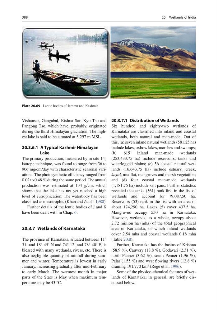
Plate 20.69 Lentic bodies of Jammu and Kashmir
20 Wetlands of India
Vishansar, Gangabal, Kishna Sar, Kyo Tso and
Pangong Tso, which have, probably, originated
during the third Himalayan glaciation. The highest lake is said to be situated at 5,297 m MSL.
20.3.6.1 A Typical Kashmir Himalayan
Lake
The primary production, measured by in situ 14 C
isotope technique, was found to range from 36 to
906 mg/cm/day with characteristic seasonal variations. The photosynthetic effi ciency ranged from
0.02 to 0.48 % during the same period. The annual
production was estimated at 134 g/cm, which
shows that the lake has not yet reached a high
level of eutrophication. The waterbody has been
classifi ed as mesotrophic (Khan and Zutshi 1980 ).
Further details of the lentic bodies of J and K
have been dealt with in Chap. 6 .
20.3.7 Wetlands of Karnataka
The province of Karnataka, situated between 11°
31′ and 18° 45′ N and 74° 12′ and 78° 40′ E, is
blessed with many wetlands, rivers, etc. There is
also negligible quantity of rainfall during summer and winter. Temperature is lowest in early
January, increasing gradually after mid-February
to early March. The warmest month in major
parts of the State is May when maximum temperature may be 43 °C.
20.3.7.1 Distribution of Wetlands
Six hundred and eighty-two wetlands of
Karnataka are classifi ed into inland and coastal
wetlands, both natural and man-made. Out of
this, (a) seven inland natural wetlands (581.25 ha)
include lakes, oxbow lakes, marshes and swamps;
(b)
615
inland
man-made
wetlands
(253,433.75 ha) include reservoirs, tanks and
waterlogged plains; (c) 56 coastal natural wetlands (16,643.75 ha) include estuary, creek,
kayal , mudfl at, mangroves and marsh vegetation;
and (d) four coastal man-made wetlands
(1,181.75 ha) include salt pans. Further statistics
revealed that tanks (561) rank fi rst in the list of
wetlands and account for 79,087.50 ha.
Reservoirs (53) rank in the list with an area of
about 174,290 ha. Lakes (5) cover 437.5 ha.
Mangroves occupy 550 ha in Karnataka.
However, wetlands, as a whole, occupy about
2.72 million ha (mha) of the total geographical
area of Karnataka, of which inland wetlands
cover 2.54 mha and coastal wetlands 0.18 mha
(Table 20.8 ).
Further, Karnataka has the basins of Krishna
(58.9 %), Cauvery (18.8 %), Godavari (2.31 %),
north Penner (3.62 %), south Penner (1.96 %),
Palar (1.55 %) and west fl owing rivers (12.8 %)
draining 191,770 km
2 (Rege et al. 1996 ).
Some of the physico-chemical features of wetlands of Karnataka, in general, are briefl y discussed below.
Plate 20.69 Lentic bodies of Jammu and Kashmir
20 Wetlands of India