

385
fi shes, crustaceans and molluscs. The mangrove
forests also protect from cyclonic storms. The
faunal diversity of the wetlands includes 70 species of sponges, 147 species of coelenterates, 179
species of corals, 161 species of polychaetes, 407
species of crustaceans, 51 species of molluscs, 70
species of fi shes, 10 species of amphibians and
242 species of birds. The wetlands support several rare species of wildlife like dugong, grey
teal, estuarine crocodile and several species of
marine turtles.
The MOEF, GOI funds for the conservation of
mangroves in the Andaman and Nicobar. Also, the
Andaman Forest Department has been conserving
the estuarine crocodile with the help of GOI.
20.3.3 Wetlands (Chaurs) of Bihar
The province of Bihar is endowed with rich
aquatic and fi shery resources in the form of rivers, fl oodplains, wetlands ( chaurs ), oxbow lakes
( mauns ), reservoirs, tanks and ponds. The main
culture fi shery resources of Bihar lie in more than
43,000 ponds and tanks of variable sizes covering
a total area of about 65,000 ha distributed
throughout the length and breadth of the State.
Floodplains and other wetlands locally known
as chaurs are other major fi shery resources and
measure about 45,978 ha which are found mainly
in the basins of Kosi–Gandak river systems of
north Bihar. Oxbow lakes, locally known as
mauns, are the discarded loops of meandering
rivers which got cut off from the main rivers and
are estimated to be about 9,000 ha. The 29 reservoirs in the State, covering total water spread
area of about 11,000 ha, are important resource
for fi sheries development. Further, 3,200 km of
rivers are the main resource for capture-based
fi sheries in the State.
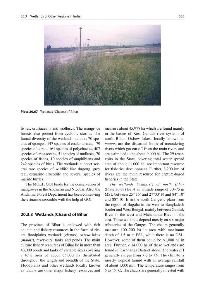
The wetlands (‘chaurs’) of north Bihar
(Plate 20.67 ) lie at an altitude range of 30–75 m
MSL between 25° 15′ and 27°00′ N and 84° 10′
and 88° 10′ E in the north Gangetic plain from
the region of Bagaha in the west to Bangladesh
border and West Bengal, mainly between Gandak
River in the west and Mahananda River in the
east. These wetlands depend mostly on six major
tributaries of the Ganges. The chaurs generally
measure 100–200 ha in area with maximum
depth of 1.5 m at FSL, while there is no DSL.
However, some of them could be >1,000 ha in
area. Further, c 14,000 ha of these wetlands are
found in Darbhanga District alone. The water pH
generally ranges from 7.6 to 7.9. The climate is
mostly tropical humid with an average rainfall
of about 1,000 mm. The temperature ranges from
5 to 45 °C. The chaurs are generally infested with
Plate 20.67 Wetlands (Chaurs) of Bihar
20.3 Wetlands of Other Regions in India
fi shes, crustaceans and molluscs. The mangrove
forests also protect from cyclonic storms. The
faunal diversity of the wetlands includes 70 species of sponges, 147 species of coelenterates, 179
species of corals, 161 species of polychaetes, 407
species of crustaceans, 51 species of molluscs, 70
species of fi shes, 10 species of amphibians and
242 species of birds. The wetlands support several rare species of wildlife like dugong, grey
teal, estuarine crocodile and several species of
marine turtles.
The MOEF, GOI funds for the conservation of
mangroves in the Andaman and Nicobar. Also, the
Andaman Forest Department has been conserving
the estuarine crocodile with the help of GOI.
20.3.3 Wetlands (Chaurs) of Bihar
The province of Bihar is endowed with rich
aquatic and fi shery resources in the form of rivers, fl oodplains, wetlands ( chaurs ), oxbow lakes
( mauns ), reservoirs, tanks and ponds. The main
culture fi shery resources of Bihar lie in more than
43,000 ponds and tanks of variable sizes covering
a total area of about 65,000 ha distributed
throughout the length and breadth of the State.
Floodplains and other wetlands locally known
as chaurs are other major fi shery resources and
measure about 45,978 ha which are found mainly
in the basins of Kosi–Gandak river systems of
north Bihar. Oxbow lakes, locally known as
mauns, are the discarded loops of meandering
rivers which got cut off from the main rivers and
are estimated to be about 9,000 ha. The 29 reservoirs in the State, covering total water spread
area of about 11,000 ha, are important resource
for fi sheries development. Further, 3,200 km of
rivers are the main resource for capture-based
fi sheries in the State.
The wetlands (‘chaurs’) of north Bihar
(Plate 20.67 ) lie at an altitude range of 30–75 m
MSL between 25° 15′ and 27°00′ N and 84° 10′
and 88° 10′ E in the north Gangetic plain from
the region of Bagaha in the west to Bangladesh
border and West Bengal, mainly between Gandak
River in the west and Mahananda River in the
east. These wetlands depend mostly on six major
tributaries of the Ganges. The chaurs generally
measure 100–200 ha in area with maximum
depth of 1.5 m at FSL, while there is no DSL.
However, some of them could be >1,000 ha in
area. Further, c 14,000 ha of these wetlands are
found in Darbhanga District alone. The water pH
generally ranges from 7.6 to 7.9. The climate is
mostly tropical humid with an average rainfall
of about 1,000 mm. The temperature ranges from
5 to 45 °C. The chaurs are generally infested with
Plate 20.67 Wetlands (Chaurs) of Bihar
20.3 Wetlands of Other Regions in India