

315
The salient biological features of the wetlands
mentioned above are given below.
Sat Beel
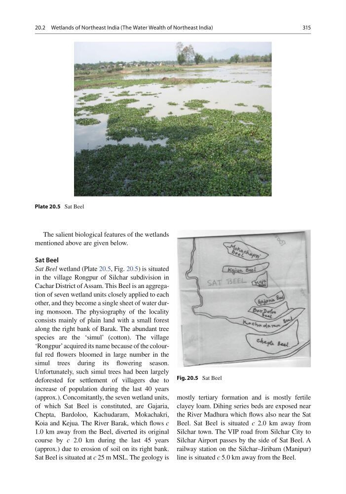
Sat Beel wetland (Plate 20.5 , Fig. 20.5 ) is situated
in the village Rongpur of Silchar subdivision in
Cachar District of Assam. This Beel is an aggregation of seven wetland units closely applied to each
other, and they become a single sheet of water during monsoon. The physiography of the locality
consists mainly of plain land with a small forest
along the right bank of Barak. The abundant tree
species are the ‘simul’ (cotton). The village
‘Rongpur’ acquired its name because of the colourful red fl owers bloomed in large number in the
simul trees during its fl owering season.
Unfortunately, such simul trees had been largely
deforested for settlement of villagers due to
increase of population during the last 40 years
(approx.). Concomitantly, the seven wetland units,
of which Sat Beel is constituted, are Gajaria,
Chepta, Bardoloo, Kachudaram, Mokachakri,
Koia and Kejua. The River Barak, which fl ows c
1.0 km away from the Beel, diverted its original
course by c 2.0 km during the last 45 years
(approx.) due to erosion of soil on its right bank.
Sat Beel is situated at c 25 m MSL. The geology is
mostly tertiary formation and is mostly fertile
clayey loam. Dihing series beds are exposed near
the River Madhura which fl ows also near the Sat
Beel. Sat Beel is situated c 2.0 km away from
Silchar town. The VIP road from Silchar City to
Silchar Airport passes by the side of Sat Beel. A
railway station on the Silchar–Jiribam (Manipur)
line is situated c 5.0 km away from the Beel.
Plate 20.5 Sat Beel
Fig. 20.5 Sat Beel
20.2 Wetlands of Northeast India (The Water Wealth of Northeast India)
The salient biological features of the wetlands
mentioned above are given below.
Sat Beel
Sat Beel wetland (Plate 20.5 , Fig. 20.5 ) is situated
in the village Rongpur of Silchar subdivision in
Cachar District of Assam. This Beel is an aggregation of seven wetland units closely applied to each
other, and they become a single sheet of water during monsoon. The physiography of the locality
consists mainly of plain land with a small forest
along the right bank of Barak. The abundant tree
species are the ‘simul’ (cotton). The village
‘Rongpur’ acquired its name because of the colourful red fl owers bloomed in large number in the
simul trees during its fl owering season.
Unfortunately, such simul trees had been largely
deforested for settlement of villagers due to
increase of population during the last 40 years
(approx.). Concomitantly, the seven wetland units,
of which Sat Beel is constituted, are Gajaria,
Chepta, Bardoloo, Kachudaram, Mokachakri,
Koia and Kejua. The River Barak, which fl ows c
1.0 km away from the Beel, diverted its original
course by c 2.0 km during the last 45 years
(approx.) due to erosion of soil on its right bank.
Sat Beel is situated at c 25 m MSL. The geology is
mostly tertiary formation and is mostly fertile
clayey loam. Dihing series beds are exposed near
the River Madhura which fl ows also near the Sat
Beel. Sat Beel is situated c 2.0 km away from
Silchar town. The VIP road from Silchar City to
Silchar Airport passes by the side of Sat Beel. A
railway station on the Silchar–Jiribam (Manipur)
line is situated c 5.0 km away from the Beel.
Plate 20.5 Sat Beel
Fig. 20.5 Sat Beel
20.2 Wetlands of Northeast India (The Water Wealth of Northeast India)