

129
Inland water resources consist of river systems,
lakes, reservoirs, village ponds and paddy fi elds.
The main water resources for coldwater fi sh are
rivers, lakes and reservoirs which comprise
approximately 48.8 % of the total water area of
Nepal, with 49 % being paddy fi elds, 1.4 %
swamps around irrigated fi elds and 0.8 % village
ponds. Collectively, these waterbodies cover
nearly 3 % of the total Nepal surface area, and it
is estimated that some 500,000 ha of water surface may be available for fi sh production (Pradhan
et al., 1966).
Nepal has a large number of rivers with perennial water supply from melting snows of the
Himalayas. There are also a considerable number
of lakes, a few reservoirs, an increasing number
of fi sh ponds and irrigated fi elds, as well as marginal swamps. All these are suitable for fi sheries
development.
There are quite a large number of lakes in
Nepal. In Pokhara Valley, some of the lakes are as
follows:
(a) Lake Phewa: It lies at 742 m MSL and has an
area and maximum depth of 523 ha and
24 m, respectively. It receives water from
two spring-fed streams, namely, Harpan and
Seti Khola.
(b) Lake Bagnas: It lies at 650 m MSL and has
an area and maximum depth of 224 ha and
10 m, respectively. The Syankudi Khola is its
main tributary, fed by a spring.
(c) Lake Rupa: It lies at 600 m MSL and is said
to be the smallest lake in Pokhara valley having an area and maximum depth of 135 ha
6 m, respectively. It receives water of Talhesi
stream (Rai et al. 1995).
Further, in western Nepal, some of the signifi -
cant lakes are as follows:
(a) Lake Rara: It lies at 2,900 m MSL and is situated about 30 km northwest of Jumla. It
receives a number of streams, and its outfl ow
is Khater Khola, which eventually joins the
River Karnali.
(b) Lake Syarpu: It lies at 1,372 m MSL and is
an oligotrophic mid-hill lake in Rukum
District, having an area of about 75 ha. It
receives water from Khare Khola (Pradhan
1982).
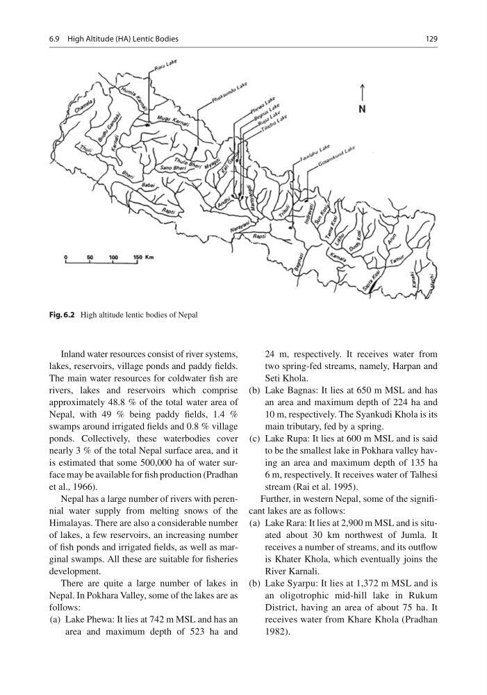
Fig. 6.2 High altitude lentic bodies of Nepal
6.9 High Altitude (HA) Lentic Bodies
Inland water resources consist of river systems,
lakes, reservoirs, village ponds and paddy fi elds.
The main water resources for coldwater fi sh are
rivers, lakes and reservoirs which comprise
approximately 48.8 % of the total water area of
Nepal, with 49 % being paddy fi elds, 1.4 %
swamps around irrigated fi elds and 0.8 % village
ponds. Collectively, these waterbodies cover
nearly 3 % of the total Nepal surface area, and it
is estimated that some 500,000 ha of water surface may be available for fi sh production (Pradhan
et al., 1966).
Nepal has a large number of rivers with perennial water supply from melting snows of the
Himalayas. There are also a considerable number
of lakes, a few reservoirs, an increasing number
of fi sh ponds and irrigated fi elds, as well as marginal swamps. All these are suitable for fi sheries
development.
There are quite a large number of lakes in
Nepal. In Pokhara Valley, some of the lakes are as
follows:
(a) Lake Phewa: It lies at 742 m MSL and has an
area and maximum depth of 523 ha and
24 m, respectively. It receives water from
two spring-fed streams, namely, Harpan and
Seti Khola.
(b) Lake Bagnas: It lies at 650 m MSL and has
an area and maximum depth of 224 ha and
10 m, respectively. The Syankudi Khola is its
main tributary, fed by a spring.
(c) Lake Rupa: It lies at 600 m MSL and is said
to be the smallest lake in Pokhara valley having an area and maximum depth of 135 ha
6 m, respectively. It receives water of Talhesi
stream (Rai et al. 1995).
Further, in western Nepal, some of the signifi -
cant lakes are as follows:
(a) Lake Rara: It lies at 2,900 m MSL and is situated about 30 km northwest of Jumla. It
receives a number of streams, and its outfl ow
is Khater Khola, which eventually joins the
River Karnali.
(b) Lake Syarpu: It lies at 1,372 m MSL and is
an oligotrophic mid-hill lake in Rukum
District, having an area of about 75 ha. It
receives water from Khare Khola (Pradhan
1982).
Fig. 6.2 High altitude lentic bodies of Nepal
6.9 High Altitude (HA) Lentic Bodies