

128
Mangdi, Phepsu, Gaylegphug up to 1,200 m
MSL), Tor tor and T. putitora (generally recorded
in streams in the foothills), Schizothoraichthys
progastus (rivers Sankosh, Chamkhar, Kuru,
Manas, Haa, Mangdi), Crossocheilus latius (rivers
Manas, Sarbhang Khola, Gaylegphug), Barilius
barna (rivers Manas, Sarbhang Khola, Gaylegphug,
Phepsu), Garra gotyla (rivers Sankosh, Sarbhang
Khola, Phepsu, Mangdi) and so on (Dubey 1978 ;
Dhendup and Boyd 1994 ). From the quite rich
water resources, the total fi sh production of Bhutan
was estimated to be 331 metric tonnes (mt) in
1990, part of it coming from warm water pond
aquaculture in the southern lowlands. The production probably declined in the subsequent years.
Further, construction of new hydroelectric power
dams resulting in new reservoirs offer considerable scope for augmenting fi sh production.
There is, possibly, no full-time fi shermen or
fi shermen’s cooperative society in Bhutan.
However, angling is practised, especially in
Thimphu and Paro rivers. Further, there was no
organised marketing of fi sh in Bhutan during the
1980s. A fi sh stall in the capital city of Thimphu,
used to sell both fresh fi sh (catla, mahseer, etc.)
and mutton, beef, etc.
A 20-year master plan for the development of
Bhutan’s hydroelectric potential, sponsored by
the World Bank, with the UNDP and Norwegian
Government assistance, suggests that in the near
future there will be more reservoirs in Bhutan, in
which coldwater fi shery could be developed
(Anon 1990 ).
6.9.2.3 High Altitude Lentic Bodies
of Nepal
Major Waterbodies of Nepal
Nepal, situated between 26° 20′–30° 10′ N and
80° 15′–88° 19′ E, is a little landlocked country,
bordering Tibet (China) in the north, and India in
the south, east and west. Nepal (Fig. 6.2 ) is
divided into three parallel geographical zones
running east to west, namely, (a) the Terai plains
in the south (which is an extension of the Gangetic
plains of India), (b) the hills (which are the foothills of the Himalayas, located in the middle part
of the country varying in altitude from 610 to
4877 m MSL, with the lower hills up to 2,700 m
and upper hills to 4,877 m) and (c) the Himalayan
mountains (the hilly area located from above
4877 m MSL). Mountains and hills cover 83 % of
Nepal, while the Terai occupies only 17 %.
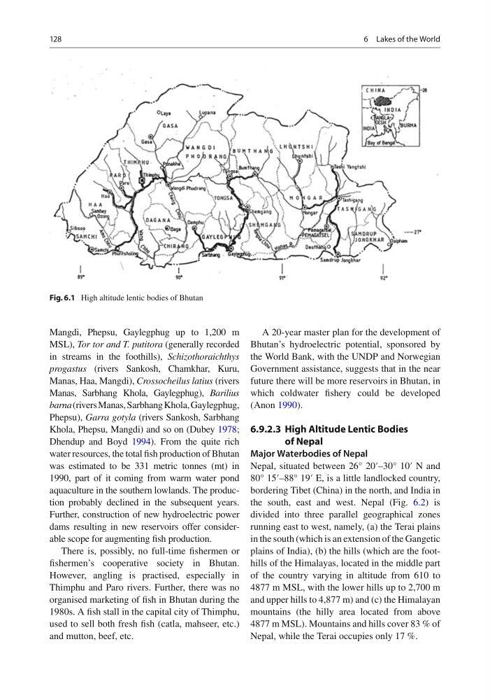
Fig. 6.1 High altitude lentic bodies of Bhutan
6 Lakes of the World
Mangdi, Phepsu, Gaylegphug up to 1,200 m
MSL), Tor tor and T. putitora (generally recorded
in streams in the foothills), Schizothoraichthys
progastus (rivers Sankosh, Chamkhar, Kuru,
Manas, Haa, Mangdi), Crossocheilus latius (rivers
Manas, Sarbhang Khola, Gaylegphug), Barilius
barna (rivers Manas, Sarbhang Khola, Gaylegphug,
Phepsu), Garra gotyla (rivers Sankosh, Sarbhang
Khola, Phepsu, Mangdi) and so on (Dubey 1978 ;
Dhendup and Boyd 1994 ). From the quite rich
water resources, the total fi sh production of Bhutan
was estimated to be 331 metric tonnes (mt) in
1990, part of it coming from warm water pond
aquaculture in the southern lowlands. The production probably declined in the subsequent years.
Further, construction of new hydroelectric power
dams resulting in new reservoirs offer considerable scope for augmenting fi sh production.
There is, possibly, no full-time fi shermen or
fi shermen’s cooperative society in Bhutan.
However, angling is practised, especially in
Thimphu and Paro rivers. Further, there was no
organised marketing of fi sh in Bhutan during the
1980s. A fi sh stall in the capital city of Thimphu,
used to sell both fresh fi sh (catla, mahseer, etc.)
and mutton, beef, etc.
A 20-year master plan for the development of
Bhutan’s hydroelectric potential, sponsored by
the World Bank, with the UNDP and Norwegian
Government assistance, suggests that in the near
future there will be more reservoirs in Bhutan, in
which coldwater fi shery could be developed
(Anon 1990 ).
6.9.2.3 High Altitude Lentic Bodies
of Nepal
Major Waterbodies of Nepal
Nepal, situated between 26° 20′–30° 10′ N and
80° 15′–88° 19′ E, is a little landlocked country,
bordering Tibet (China) in the north, and India in
the south, east and west. Nepal (Fig. 6.2 ) is
divided into three parallel geographical zones
running east to west, namely, (a) the Terai plains
in the south (which is an extension of the Gangetic
plains of India), (b) the hills (which are the foothills of the Himalayas, located in the middle part
of the country varying in altitude from 610 to
4877 m MSL, with the lower hills up to 2,700 m
and upper hills to 4,877 m) and (c) the Himalayan
mountains (the hilly area located from above
4877 m MSL). Mountains and hills cover 83 % of
Nepal, while the Terai occupies only 17 %.
Fig. 6.1 High altitude lentic bodies of Bhutan
6 Lakes of the World