

109
Village, the last village in the Indian territory.
The water of the lake is very calm. There are
many lotus fl owers in the lake. The lake could be
reached via Lakshmi Forest. It may take 3 days
on foot to return to Badrinath.
Shyamla Tal
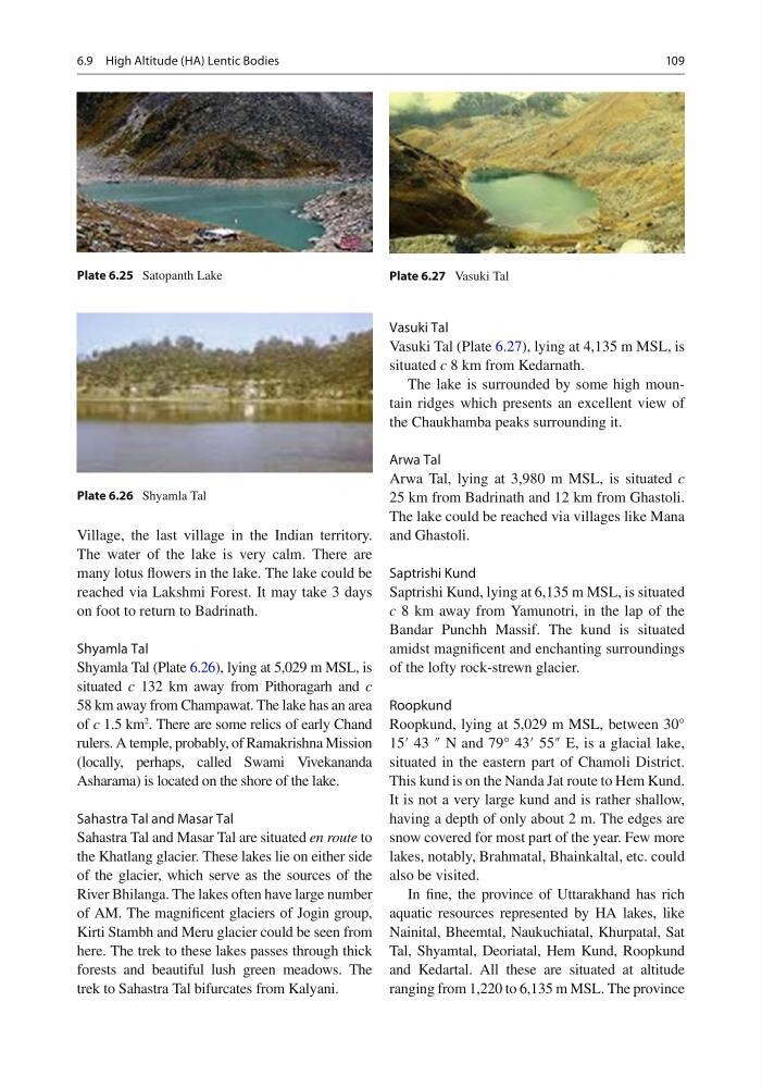
Shyamla Tal (Plate 6.26 ), lying at 5,029 m MSL, is
situated c 132 km away from Pithoragarh and c
58 km away from Champawat. The lake has an area
of c 1.5 km
2
. There are some relics of early Chand
rulers. A temple, probably, of Ramakrishna Mission
(locally, perhaps, called Swami Vivekananda
Asharama) is located on the shore of the lake.
Sahastra Tal and Masar Tal
Sahastra Tal and Masar Tal are situated en route to
the Khatlang glacier. These lakes lie on either side
of the glacier, which serve as the sources of the
River Bhilanga. The lakes often have large number
of AM. The magnifi cent glaciers of Jogin group,
Kirti Stambh and Meru glacier could be seen from
here. The trek to these lakes passes through thick
forests and beautiful lush green meadows. The
trek to Sahastra Tal bifurcates from Kalyani.
Vasuki Tal
Vasuki Tal (Plate 6.27 ), lying at 4,135 m MSL, is
situated c 8 km from Kedarnath.
The lake is surrounded by some high mountain ridges which presents an excellent view of
the Chaukhamba peaks surrounding it.
Arwa Tal
Arwa Tal, lying at 3,980 m MSL, is situated c
25 km from Badrinath and 12 km from Ghastoli.
The lake could be reached via villages like Mana
and Ghastoli.
Saptrishi Kund
Saptrishi Kund, lying at 6,135 m MSL, is situated
c 8 km away from Yamunotri, in the lap of the
Bandar Punchh Massif. The kund is situated
amidst magnifi cent and enchanting surroundings
of the lofty rock-strewn glacier.
Roopkund
Roopkund, lying at 5,029 m MSL, between 30°
15′ 43 ″ N and 79° 43′ 55″ E, is a glacial lake,
situated in the eastern part of Chamoli District.
This kund is on the Nanda Jat route to Hem Kund.
It is not a very large kund and is rather shallow,
having a depth of only about 2 m. The edges are
snow covered for most part of the year. Few more
lakes, notably, Brahmatal, Bhainkaltal, etc. could
also be visited.
In fi ne, the province of Uttarakhand has rich
aquatic resources represented by HA lakes, like
Nainital, Bheemtal, Naukuchiatal, Khurpatal, Sat
Tal, Shyamtal, Deoriatal, Hem Kund, Roopkund
and Kedartal. All these are situated at altitude
ranging from 1,220 to 6,135 m MSL. The province
Plate 6.25 Satopanth Lake
Plate 6.26 Shyamla Tal
Plate 6.27 Vasuki Tal
6.9 High Altitude (HA) Lentic Bodies
Village, the last village in the Indian territory.
The water of the lake is very calm. There are
many lotus fl owers in the lake. The lake could be
reached via Lakshmi Forest. It may take 3 days
on foot to return to Badrinath.
Shyamla Tal
Shyamla Tal (Plate 6.26 ), lying at 5,029 m MSL, is
situated c 132 km away from Pithoragarh and c
58 km away from Champawat. The lake has an area
of c 1.5 km
2
. There are some relics of early Chand
rulers. A temple, probably, of Ramakrishna Mission
(locally, perhaps, called Swami Vivekananda
Asharama) is located on the shore of the lake.
Sahastra Tal and Masar Tal
Sahastra Tal and Masar Tal are situated en route to
the Khatlang glacier. These lakes lie on either side
of the glacier, which serve as the sources of the
River Bhilanga. The lakes often have large number
of AM. The magnifi cent glaciers of Jogin group,
Kirti Stambh and Meru glacier could be seen from
here. The trek to these lakes passes through thick
forests and beautiful lush green meadows. The
trek to Sahastra Tal bifurcates from Kalyani.
Vasuki Tal
Vasuki Tal (Plate 6.27 ), lying at 4,135 m MSL, is
situated c 8 km from Kedarnath.
The lake is surrounded by some high mountain ridges which presents an excellent view of
the Chaukhamba peaks surrounding it.
Arwa Tal
Arwa Tal, lying at 3,980 m MSL, is situated c
25 km from Badrinath and 12 km from Ghastoli.
The lake could be reached via villages like Mana
and Ghastoli.
Saptrishi Kund
Saptrishi Kund, lying at 6,135 m MSL, is situated
c 8 km away from Yamunotri, in the lap of the
Bandar Punchh Massif. The kund is situated
amidst magnifi cent and enchanting surroundings
of the lofty rock-strewn glacier.
Roopkund
Roopkund, lying at 5,029 m MSL, between 30°
15′ 43 ″ N and 79° 43′ 55″ E, is a glacial lake,
situated in the eastern part of Chamoli District.
This kund is on the Nanda Jat route to Hem Kund.
It is not a very large kund and is rather shallow,
having a depth of only about 2 m. The edges are
snow covered for most part of the year. Few more
lakes, notably, Brahmatal, Bhainkaltal, etc. could
also be visited.
In fi ne, the province of Uttarakhand has rich
aquatic resources represented by HA lakes, like
Nainital, Bheemtal, Naukuchiatal, Khurpatal, Sat
Tal, Shyamtal, Deoriatal, Hem Kund, Roopkund
and Kedartal. All these are situated at altitude
ranging from 1,220 to 6,135 m MSL. The province
Plate 6.25 Satopanth Lake
Plate 6.26 Shyamla Tal
Plate 6.27 Vasuki Tal
6.9 High Altitude (HA) Lentic Bodies