

108
Kashni Tal Lake
Madhyamaheshwar is a beautiful temple in the
Garhwal Himalayas, in a valley between
Badrinath and Kedarnath. A river called
Madhyamaheshwar Ganga originates in a deep
ravine below.
Kagbhusand Tal Lake
The Kagbhusand Tal (Plate 6.22 ), lying at c
5,230 m MSL, near Kankul Pass, is a small
oblong lake with emerald-green water. The lake
is almost a kilometre long. It could be reached by
a 20-km trek on the Valley of Flowers road, from
a village called Bhyundar. Two huge rocks are
popularly described as a crow (Kaga) and an
eagle (Garuda).
Kedartal Lake
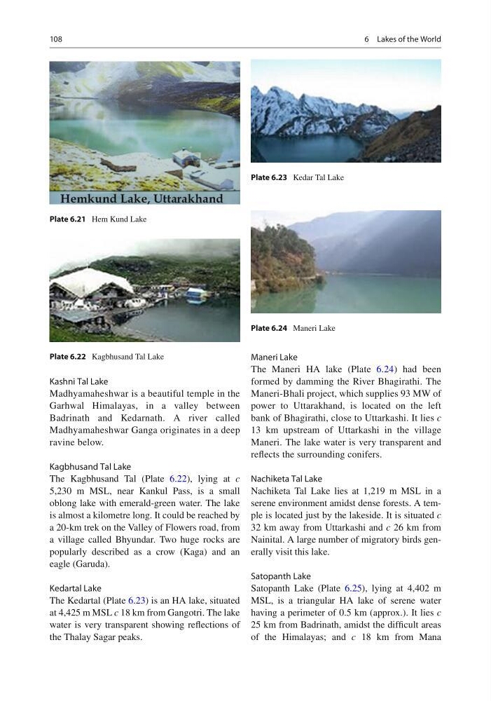
The Kedartal (Plate 6.23 ) is an HA lake, situated
at 4,425 m MSL c 18 km from Gangotri. The lake
water is very transparent showing refl ections of
the Thalay Sagar peaks.
Maneri Lake
The Maneri HA lake (Plate 6.24 ) had been
formed by damming the River Bhagirathi. The
Maneri-Bhali project, which supplies 93 MW of
power to Uttarakhand, is located on the left
bank of Bhagirathi, close to Uttarkashi. It lies c
13 km upstream of Uttarkashi in the village
Maneri. The lake water is very transparent and
refl ects the surrounding conifers.
Nachiketa Tal Lake
Nachiketa Tal Lake lies at 1,219 m MSL in a
serene environment amidst dense forests. A temple is located just by the lakeside. It is situated c
32 km away from Uttarkashi and c 26 km from
Nainital. A large number of migratory birds generally visit this lake.
Satopanth Lake
Satopanth Lake (Plate 6.25 ), lying at 4,402 m
MSL, is a triangular HA lake of serene water
having a perimeter of 0.5 km (approx.). It lies c
25 km from Badrinath, amidst the diffi cult areas
of the Himalayas; and c 18 km from Mana
Plate 6.21 Hem Kund Lake
Plate 6.22 Kagbhusand Tal Lake
Plate 6.23 Kedar Tal Lake
Plate 6.24 Maneri Lake
6 Lakes of the World
Kashni Tal Lake
Madhyamaheshwar is a beautiful temple in the
Garhwal Himalayas, in a valley between
Badrinath and Kedarnath. A river called
Madhyamaheshwar Ganga originates in a deep
ravine below.
Kagbhusand Tal Lake
The Kagbhusand Tal (Plate 6.22 ), lying at c
5,230 m MSL, near Kankul Pass, is a small
oblong lake with emerald-green water. The lake
is almost a kilometre long. It could be reached by
a 20-km trek on the Valley of Flowers road, from
a village called Bhyundar. Two huge rocks are
popularly described as a crow (Kaga) and an
eagle (Garuda).
Kedartal Lake
The Kedartal (Plate 6.23 ) is an HA lake, situated
at 4,425 m MSL c 18 km from Gangotri. The lake
water is very transparent showing refl ections of
the Thalay Sagar peaks.
Maneri Lake
The Maneri HA lake (Plate 6.24 ) had been
formed by damming the River Bhagirathi. The
Maneri-Bhali project, which supplies 93 MW of
power to Uttarakhand, is located on the left
bank of Bhagirathi, close to Uttarkashi. It lies c
13 km upstream of Uttarkashi in the village
Maneri. The lake water is very transparent and
refl ects the surrounding conifers.
Nachiketa Tal Lake
Nachiketa Tal Lake lies at 1,219 m MSL in a
serene environment amidst dense forests. A temple is located just by the lakeside. It is situated c
32 km away from Uttarkashi and c 26 km from
Nainital. A large number of migratory birds generally visit this lake.
Satopanth Lake
Satopanth Lake (Plate 6.25 ), lying at 4,402 m
MSL, is a triangular HA lake of serene water
having a perimeter of 0.5 km (approx.). It lies c
25 km from Badrinath, amidst the diffi cult areas
of the Himalayas; and c 18 km from Mana
Plate 6.21 Hem Kund Lake
Plate 6.22 Kagbhusand Tal Lake
Plate 6.23 Kedar Tal Lake
Plate 6.24 Maneri Lake
6 Lakes of the World