

90
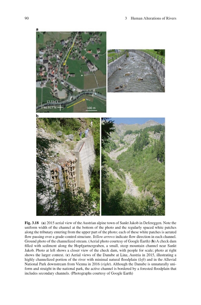
Fig. 3.18 (a) 2015 aerial view of the Austrian alpine town of Sankt Jakob in Defereggen. Note the
uniform width of the channel at the bottom of the photo and the regularly spaced white patches
along the tributary entering from the upper part of the photo; each of these white patches is aerated
flow passing over a grade-control structure. Yellow arrows indicate flow direction in each channel.
Ground photo of the channelized stream. (Aerial photo courtesy of Google Earth) (b) A check dam
filled with sediment along the Hopfgartnergraben, a small, steep mountain channel near Sankt
Jakob. Photo at left shows a closer view of the check dam, with people for scale; photo at right
shows the larger context. (c) Aerial views of the Danube at Linz, Austria in 2015, illustrating a
highly channelized portion of the river with minimal natural floodplain (left) and in the Alluvial
National Park downstream from Vienna in 2016 (right). Although the Danube is unnaturally uniform and straight in the national park, the active channel is bordered by a forested floodplain that
includes secondary channels. (Photographs courtesy of Google Earth)
3 Human Alterations of Rivers
Fig. 3.18 (a) 2015 aerial view of the Austrian alpine town of Sankt Jakob in Defereggen. Note the
uniform width of the channel at the bottom of the photo and the regularly spaced white patches
along the tributary entering from the upper part of the photo; each of these white patches is aerated
flow passing over a grade-control structure. Yellow arrows indicate flow direction in each channel.
Ground photo of the channelized stream. (Aerial photo courtesy of Google Earth) (b) A check dam
filled with sediment along the Hopfgartnergraben, a small, steep mountain channel near Sankt
Jakob. Photo at left shows a closer view of the check dam, with people for scale; photo at right
shows the larger context. (c) Aerial views of the Danube at Linz, Austria in 2015, illustrating a
highly channelized portion of the river with minimal natural floodplain (left) and in the Alluvial
National Park downstream from Vienna in 2016 (right). Although the Danube is unnaturally uniform and straight in the national park, the active channel is bordered by a forested floodplain that
includes secondary channels. (Photographs courtesy of Google Earth)
3 Human Alterations of Rivers