

50
P. Cepuder and V. aus-der-Schmitten
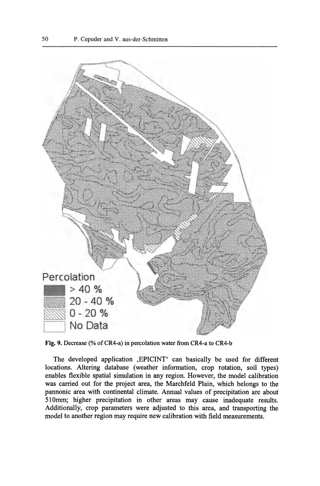
Percolation
> 40 %
20 - 40 %
0- 20 %
No Data
Fig. 9. Decrease (% ofCR4-a) in percolation water from CR4-a to CR4-b
The developed application ,EPICINT' can basically be used for different
locations. Altering database (weather information, crop rotation, soil types)
enables flexible spatial simulation in any region. However, the model calibration
was carried out for the project area, the Marchfeld Plain, which belongs to the
pannonic area with continental climate. Annual values of precipitation are about
510mm; higher precipitation in other areas may cause inadequate results.
Additionally, crop parameters were adjusted to this area, and transporting the
model to another region may require new calibration with field measurements.
P. Cepuder and V. aus-der-Schmitten
Percolation
> 40 %
20 - 40 %
0- 20 %
No Data
Fig. 9. Decrease (% ofCR4-a) in percolation water from CR4-a to CR4-b
The developed application ,EPICINT' can basically be used for different
locations. Altering database (weather information, crop rotation, soil types)
enables flexible spatial simulation in any region. However, the model calibration
was carried out for the project area, the Marchfeld Plain, which belongs to the
pannonic area with continental climate. Annual values of precipitation are about
510mm; higher precipitation in other areas may cause inadequate results.
Additionally, crop parameters were adjusted to this area, and transporting the
model to another region may require new calibration with field measurements.