

182
D. Markel and U. Shamir
3 The Monitoring System
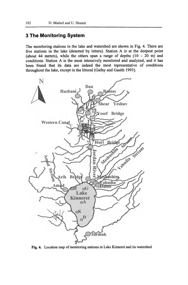
The monitoring stations in the lake and watershed are shown in Fig. 4. There are
five stations in the lake (denoted by letters). Station A is at the deepest point
(about 44 meters), while the others span a range of depths (10 - 20 m) and
conditions. Station A is the most intensively monitored and analyzed, and it has
been found that its data are indeed the most representative of conditions
throughout the lake, except in the littoral (Gafny and Gasith 1993).
N
A
Fig. 4. Location map of monitoring stations in Lake Kinneret and its watershed
D. Markel and U. Shamir
3 The Monitoring System
The monitoring stations in the lake and watershed are shown in Fig. 4. There are
five stations in the lake (denoted by letters). Station A is at the deepest point
(about 44 meters), while the others span a range of depths (10 - 20 m) and
conditions. Station A is the most intensively monitored and analyzed, and it has
been found that its data are indeed the most representative of conditions
throughout the lake, except in the littoral (Gafny and Gasith 1993).
N
A
Fig. 4. Location map of monitoring stations in Lake Kinneret and its watershed