

Advanced Approach for Synoptic Monitoring ofa Lake Ecosystem
167
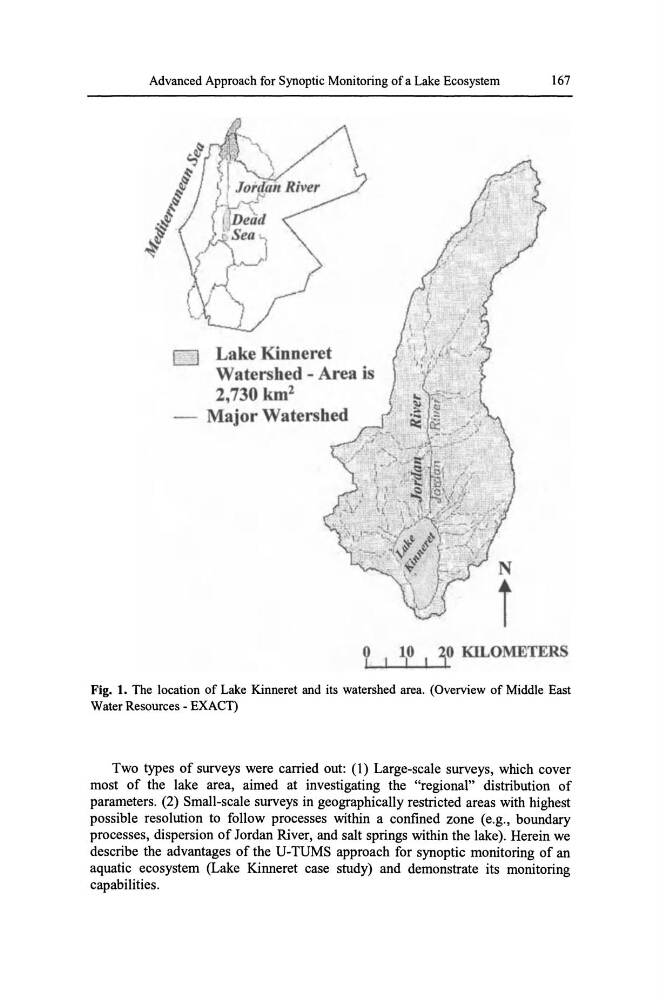
o Lake Kinneret
Watershed - Area is
2,730 km 2
Major Watershed
i
TERS
Fig. 1. The location of Lake Kinneret and its watershed area. (Overview of Middle East
Water Resources - EXACT)
Two types of surveys were carried out: (1) Large-scale surveys, which cover
most of the lake area, aimed at investigating the "regional" distribution of
parameters. (2) Small-scale surveys in geographically restricted areas with highest
possible resolution to follow processes within a confined zone (e.g., boundary
processes, dispersion of Jordan River, and salt springs within the lake). Herein we
describe the advantages of the U-TUMS approach for synoptic monitoring of an
aquatic ecosystem (Lake Kinneret case study) and demonstrate its monitoring
capabilities.
167
o Lake Kinneret
Watershed - Area is
2,730 km 2
Major Watershed
i
TERS
Fig. 1. The location of Lake Kinneret and its watershed area. (Overview of Middle East
Water Resources - EXACT)
Two types of surveys were carried out: (1) Large-scale surveys, which cover
most of the lake area, aimed at investigating the "regional" distribution of
parameters. (2) Small-scale surveys in geographically restricted areas with highest
possible resolution to follow processes within a confined zone (e.g., boundary
processes, dispersion of Jordan River, and salt springs within the lake). Herein we
describe the advantages of the U-TUMS approach for synoptic monitoring of an
aquatic ecosystem (Lake Kinneret case study) and demonstrate its monitoring
capabilities.