

199
8.2 Material and Methods
8.2.1 Study Area
The North Coast of the State of the Bahia occupies an area about 8.000 km
2
, being
formed by thirteen cities. Praia do Forte (main showed area) it is placed in the city
of Mata de São João, and is located about 60 km from the capital Salvador. It possess a littoral band with approximately 14 km of extension, throughout the North
Coast of the Bahia between the rivers Pojuca (12° 35′S, 38° 00′W) and Imbassaí
(12° 30′S, 38° 00′W), limits south and north respectively. A narrow continental
platform, with approximately 15 km of extension, it is the main oceanographic characteristic. Throughout the platform, its average of depth is of 40 m and the amplitude of tide varies between 0.1 and 2.6 m (DHN 1995).
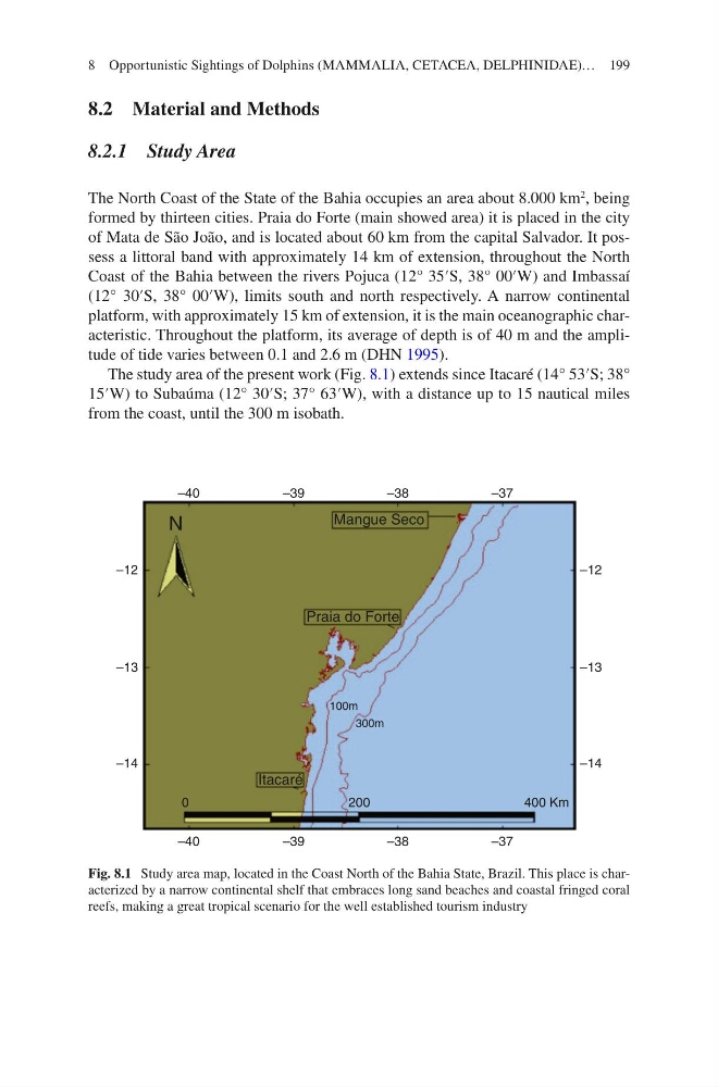
The study area of the present work (Fig. 8.1) extends since Itacaré (14° 53′S; 38°
15′W) to Subaúma (12° 30′S; 37° 63′W), with a distance up to 15 nautical miles
from the coast, until the 300 m isobath.
–12
–13
–14
–12
–13
–14
–40
–39
–38
–37
–40
–39
–38
–37
200
0
400 Km
Mangue Seco
Praia do Forte
100m
300m
Itacaré
N
Fig. 8.1 Study area map, located in the Coast North of the Bahia State, Brazil. This place is characterized by a narrow continental shelf that embraces long sand beaches and coastal fringed coral
reefs, making a great tropical scenario for the well established tourism industry
8 Opportunistic Sightings of Dolphins (MAMMALIA, CETACEA, DELPHINIDAE)…
8.2 Material and Methods
8.2.1 Study Area
The North Coast of the State of the Bahia occupies an area about 8.000 km
2
, being
formed by thirteen cities. Praia do Forte (main showed area) it is placed in the city
of Mata de São João, and is located about 60 km from the capital Salvador. It possess a littoral band with approximately 14 km of extension, throughout the North
Coast of the Bahia between the rivers Pojuca (12° 35′S, 38° 00′W) and Imbassaí
(12° 30′S, 38° 00′W), limits south and north respectively. A narrow continental
platform, with approximately 15 km of extension, it is the main oceanographic characteristic. Throughout the platform, its average of depth is of 40 m and the amplitude of tide varies between 0.1 and 2.6 m (DHN 1995).
The study area of the present work (Fig. 8.1) extends since Itacaré (14° 53′S; 38°
15′W) to Subaúma (12° 30′S; 37° 63′W), with a distance up to 15 nautical miles
from the coast, until the 300 m isobath.
–12
–13
–14
–12
–13
–14
–40
–39
–38
–37
–40
–39
–38
–37
200
0
400 Km
Mangue Seco
Praia do Forte
100m
300m
Itacaré
N
Fig. 8.1 Study area map, located in the Coast North of the Bahia State, Brazil. This place is characterized by a narrow continental shelf that embraces long sand beaches and coastal fringed coral
reefs, making a great tropical scenario for the well established tourism industry
8 Opportunistic Sightings of Dolphins (MAMMALIA, CETACEA, DELPHINIDAE)…