

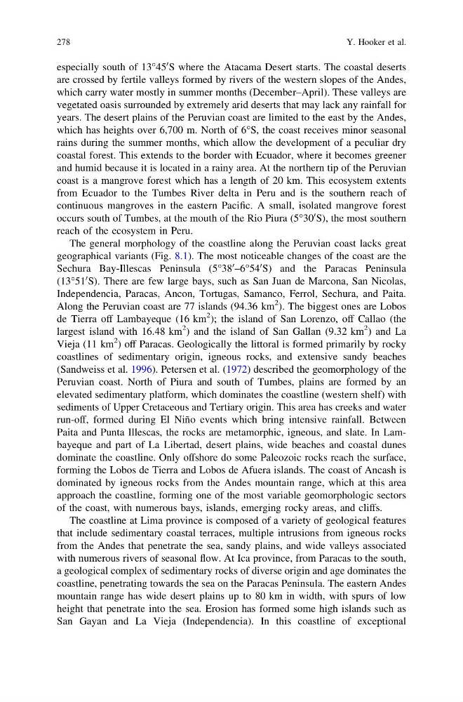
especially south of 13°45
0 S where the Atacama Desert starts. The coastal deserts
are crossed by fertile valleys formed by rivers of the western slopes of the Andes,
which carry water mostly in summer months (December–April). These valleys are
vegetated oasis surrounded by extremely arid deserts that may lack any rainfall for
years. The desert plains of the Peruvian coast are limited to the east by the Andes,
which has heights over 6,700 m. North of 6°S, the coast receives minor seasonal
rains during the summer months, which allow the development of a peculiar dry
coastal forest. This extends to the border with Ecuador, where it becomes greener
and humid because it is located in a rainy area. At the northern tip of the Peruvian
coast is a mangrove forest which has a length of 20 km. This ecosystem extents
from Ecuador to the Tumbes River delta in Peru and is the southern reach of
continuous mangroves in the eastern Pacific. A small, isolated mangrove forest
occurs south of Tumbes, at the mouth of the Rio Piura (5°30
0 S), the most southern
reach of the ecosystem in Peru.
The general morphology of the coastline along the Peruvian coast lacks great
geographical variants (Fig. 8.1). The most noticeable changes of the coast are the
Sechura Bay-Illescas Peninsula (5°38
0 –6°54
0 S) and the Paracas Peninsula
(13°51
0 S). There are few large bays, such as San Juan de Marcona, San Nicolas,
Independencia, Paracas, Ancon, Tortugas, Samanco, Ferrol, Sechura, and Paita.
Along the Peruvian coast are 77 islands (94.36 km
2 ). The biggest ones are Lobos
de Tierra off Lambayeque (16 km
2 ); the island of San Lorenzo, off Callao (the
largest island with 16.48 km
2 ) and the island of San Gallan (9.32 km
2 ) and La
Vieja (11 km
2 ) off Paracas. Geologically the littoral is formed primarily by rocky
coastlines of sedimentary origin, igneous rocks, and extensive sandy beaches
(Sandweiss et al. 1996). Petersen et al. (1972) described the geomorphology of the
Peruvian coast. North of Piura and south of Tumbes, plains are formed by an
elevated sedimentary platform, which dominates the coastline (western shelf) with
sediments of Upper Cretaceous and Tertiary origin. This area has creeks and water
run-off, formed during El Niño events which bring intensive rainfall. Between
Paita and Punta Illescas, the rocks are metamorphic, igneous, and slate. In Lambayeque and part of La Libertad, desert plains, wide beaches and coastal dunes
dominate the coastline. Only offshore do some Paleozoic rocks reach the surface,
forming the Lobos de Tierra and Lobos de Afuera islands. The coast of Ancash is
dominated by igneous rocks from the Andes mountain range, which at this area
approach the coastline, forming one of the most variable geomorphologic sectors
of the coast, with numerous bays, islands, emerging rocky areas, and cliffs.
The coastline at Lima province is composed of a variety of geological features
that include sedimentary coastal terraces, multiple intrusions from igneous rocks
from the Andes that penetrate the sea, sandy plains, and wide valleys associated
with numerous rivers of seasonal flow. At Ica province, from Paracas to the south,
a geological complex of sedimentary rocks of diverse origin and age dominates the
coastline, penetrating towards the sea on the Paracas Peninsula. The eastern Andes
mountain range has wide desert plains up to 80 km in width, with spurs of low
height that penetrate into the sea. Erosion has formed some high islands such as
San Gayan and La Vieja (Independencia). In this coastline of exceptional
278
Y. Hooker et al.
0 S where the Atacama Desert starts. The coastal deserts
are crossed by fertile valleys formed by rivers of the western slopes of the Andes,
which carry water mostly in summer months (December–April). These valleys are
vegetated oasis surrounded by extremely arid deserts that may lack any rainfall for
years. The desert plains of the Peruvian coast are limited to the east by the Andes,
which has heights over 6,700 m. North of 6°S, the coast receives minor seasonal
rains during the summer months, which allow the development of a peculiar dry
coastal forest. This extends to the border with Ecuador, where it becomes greener
and humid because it is located in a rainy area. At the northern tip of the Peruvian
coast is a mangrove forest which has a length of 20 km. This ecosystem extents
from Ecuador to the Tumbes River delta in Peru and is the southern reach of
continuous mangroves in the eastern Pacific. A small, isolated mangrove forest
occurs south of Tumbes, at the mouth of the Rio Piura (5°30
0 S), the most southern
reach of the ecosystem in Peru.
The general morphology of the coastline along the Peruvian coast lacks great
geographical variants (Fig. 8.1). The most noticeable changes of the coast are the
Sechura Bay-Illescas Peninsula (5°38
0 –6°54
0 S) and the Paracas Peninsula
(13°51
0 S). There are few large bays, such as San Juan de Marcona, San Nicolas,
Independencia, Paracas, Ancon, Tortugas, Samanco, Ferrol, Sechura, and Paita.
Along the Peruvian coast are 77 islands (94.36 km
2 ). The biggest ones are Lobos
de Tierra off Lambayeque (16 km
2 ); the island of San Lorenzo, off Callao (the
largest island with 16.48 km
2 ) and the island of San Gallan (9.32 km
2 ) and La
Vieja (11 km
2 ) off Paracas. Geologically the littoral is formed primarily by rocky
coastlines of sedimentary origin, igneous rocks, and extensive sandy beaches
(Sandweiss et al. 1996). Petersen et al. (1972) described the geomorphology of the
Peruvian coast. North of Piura and south of Tumbes, plains are formed by an
elevated sedimentary platform, which dominates the coastline (western shelf) with
sediments of Upper Cretaceous and Tertiary origin. This area has creeks and water
run-off, formed during El Niño events which bring intensive rainfall. Between
Paita and Punta Illescas, the rocks are metamorphic, igneous, and slate. In Lambayeque and part of La Libertad, desert plains, wide beaches and coastal dunes
dominate the coastline. Only offshore do some Paleozoic rocks reach the surface,
forming the Lobos de Tierra and Lobos de Afuera islands. The coast of Ancash is
dominated by igneous rocks from the Andes mountain range, which at this area
approach the coastline, forming one of the most variable geomorphologic sectors
of the coast, with numerous bays, islands, emerging rocky areas, and cliffs.
The coastline at Lima province is composed of a variety of geological features
that include sedimentary coastal terraces, multiple intrusions from igneous rocks
from the Andes that penetrate the sea, sandy plains, and wide valleys associated
with numerous rivers of seasonal flow. At Ica province, from Paracas to the south,
a geological complex of sedimentary rocks of diverse origin and age dominates the
coastline, penetrating towards the sea on the Paracas Peninsula. The eastern Andes
mountain range has wide desert plains up to 80 km in width, with spurs of low
height that penetrate into the sea. Erosion has formed some high islands such as
San Gayan and La Vieja (Independencia). In this coastline of exceptional
278
Y. Hooker et al.