

In contrast, the Gulf of Chiriquí has a narrower continental shelf and less
freshwater input from continental runoff. It contains Chiriquí National Park and
Coiba Nacional Park which has World Heritage Site status. Several island complexes are present, including the islands of Boca Brava, Los Ladrones, Islas Secas,
Parilla, Isla Palenque, Montuosa, and Isla Jicaron, with Isla Jicarita being the
island furthest south of the Panama mainland. In the northwest of the gulf, water
depth gradually increases down the continental shelf. However, in the east, water
depth sharply drops to 160 m before plunging down the continental slope and
reaching a depth of 1,000 m less than a 1 km south of the Azuero Peninsula. The
Gulf of Chiriquí is shielded from the trade winds out of the North by the Central
Cordillera and therefore experiences no seasonal upwelling. The Gulf of Chiriquí
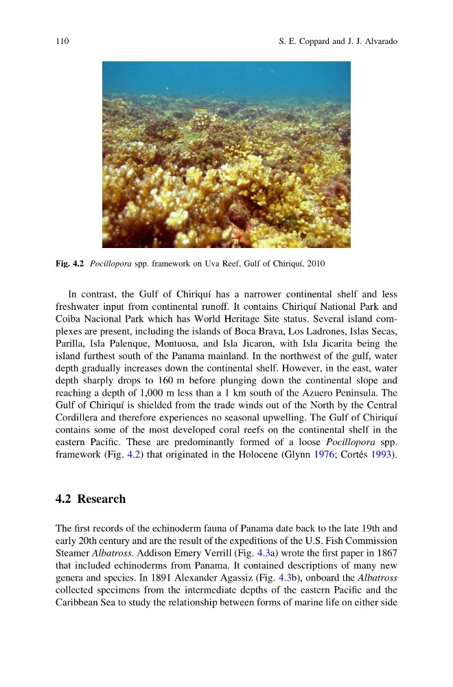
contains some of the most developed coral reefs on the continental shelf in the
eastern Pacific. These are predominantly formed of a loose Pocillopora spp.
framework (Fig. 4.2) that originated in the Holocene (Glynn 1976; Cortés 1993).
4.2 Research
The first records of the echinoderm fauna of Panama date back to the late 19th and
early 20th century and are the result of the expeditions of the U.S. Fish Commission
Steamer Albatross. Addison Emery Verrill (Fig. 4.3a) wrote the first paper in 1867
that included echinoderms from Panama. It contained descriptions of many new
genera and species. In 1891 Alexander Agassiz (Fig. 4.3b), onboard the Albatross
collected specimens from the intermediate depths of the eastern Pacific and the
Caribbean Sea to study the relationship between forms of marine life on either side
Fig. 4.2 Pocillopora spp. framework on Uva Reef, Gulf of Chiriquí, 2010
110
S. E. Coppard and J. J. Alvarado
freshwater input from continental runoff. It contains Chiriquí National Park and
Coiba Nacional Park which has World Heritage Site status. Several island complexes are present, including the islands of Boca Brava, Los Ladrones, Islas Secas,
Parilla, Isla Palenque, Montuosa, and Isla Jicaron, with Isla Jicarita being the
island furthest south of the Panama mainland. In the northwest of the gulf, water
depth gradually increases down the continental shelf. However, in the east, water
depth sharply drops to 160 m before plunging down the continental slope and
reaching a depth of 1,000 m less than a 1 km south of the Azuero Peninsula. The
Gulf of Chiriquí is shielded from the trade winds out of the North by the Central
Cordillera and therefore experiences no seasonal upwelling. The Gulf of Chiriquí
contains some of the most developed coral reefs on the continental shelf in the
eastern Pacific. These are predominantly formed of a loose Pocillopora spp.
framework (Fig. 4.2) that originated in the Holocene (Glynn 1976; Cortés 1993).
4.2 Research
The first records of the echinoderm fauna of Panama date back to the late 19th and
early 20th century and are the result of the expeditions of the U.S. Fish Commission
Steamer Albatross. Addison Emery Verrill (Fig. 4.3a) wrote the first paper in 1867
that included echinoderms from Panama. It contained descriptions of many new
genera and species. In 1891 Alexander Agassiz (Fig. 4.3b), onboard the Albatross
collected specimens from the intermediate depths of the eastern Pacific and the
Caribbean Sea to study the relationship between forms of marine life on either side
Fig. 4.2 Pocillopora spp. framework on Uva Reef, Gulf of Chiriquí, 2010
110
S. E. Coppard and J. J. Alvarado