

78
G. Lericolais
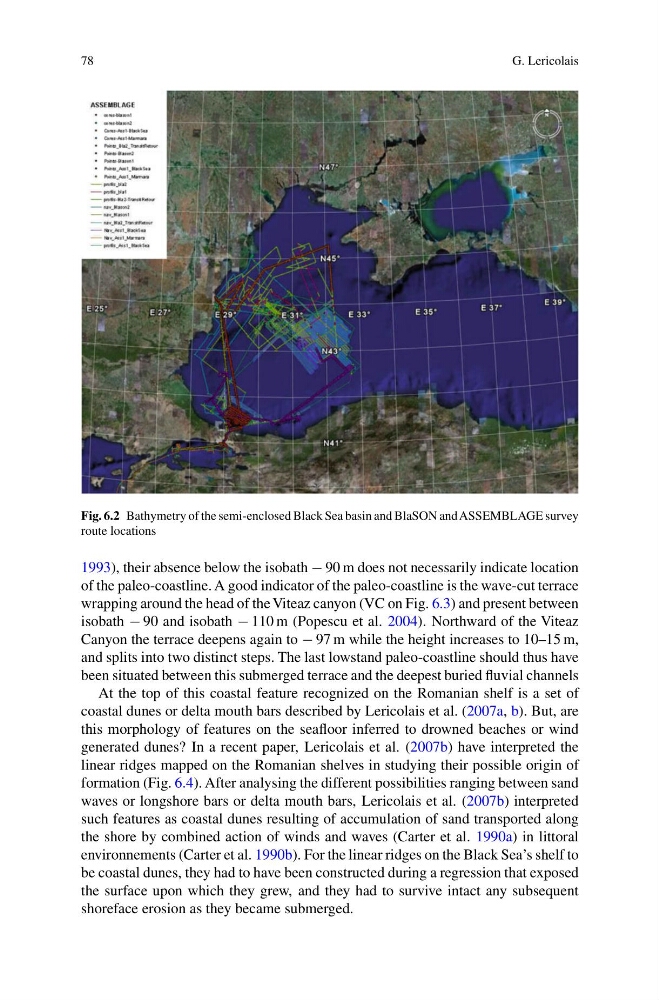
Fig. 6.2 Bathymetry of the semi-enclosed Black Sea basin and BlaSON and ASSEMBLAGE survey
route locations
1993), their absence below the isobath − 90 m does not necessarily indicate location
of the paleo-coastline. A good indicator of the paleo-coastline is the wave-cut terrace
wrapping around the head of the Viteaz canyon (VC on Fig. 6.3) and present between
isobath − 90 and isobath − 110 m (Popescu et al. 2004). Northward of the Viteaz
Canyon the terrace deepens again to − 97 m while the height increases to 10–15 m,
and splits into two distinct steps. The last lowstand paleo-coastline should thus have
been situated between this submerged terrace and the deepest buried fluvial channels
At the top of this coastal feature recognized on the Romanian shelf is a set of
coastal dunes or delta mouth bars described by Lericolais et al. (2007a, b). But, are
this morphology of features on the seafloor inferred to drowned beaches or wind
generated dunes? In a recent paper, Lericolais et al. (2007b) have interpreted the
linear ridges mapped on the Romanian shelves in studying their possible origin of
formation (Fig. 6.4). After analysing the different possibilities ranging between sand
waves or longshore bars or delta mouth bars, Lericolais et al. (2007b) interpreted
such features as coastal dunes resulting of accumulation of sand transported along
the shore by combined action of winds and waves (Carter et al. 1990a) in littoral
environnements (Carter et al. 1990b). For the linear ridges on the Black Sea’s shelf to
be coastal dunes, they had to have been constructed during a regression that exposed
the surface upon which they grew, and they had to survive intact any subsequent
shoreface erosion as they became submerged.
G. Lericolais
Fig. 6.2 Bathymetry of the semi-enclosed Black Sea basin and BlaSON and ASSEMBLAGE survey
route locations
1993), their absence below the isobath − 90 m does not necessarily indicate location
of the paleo-coastline. A good indicator of the paleo-coastline is the wave-cut terrace
wrapping around the head of the Viteaz canyon (VC on Fig. 6.3) and present between
isobath − 90 and isobath − 110 m (Popescu et al. 2004). Northward of the Viteaz
Canyon the terrace deepens again to − 97 m while the height increases to 10–15 m,
and splits into two distinct steps. The last lowstand paleo-coastline should thus have
been situated between this submerged terrace and the deepest buried fluvial channels
At the top of this coastal feature recognized on the Romanian shelf is a set of
coastal dunes or delta mouth bars described by Lericolais et al. (2007a, b). But, are
this morphology of features on the seafloor inferred to drowned beaches or wind
generated dunes? In a recent paper, Lericolais et al. (2007b) have interpreted the
linear ridges mapped on the Romanian shelves in studying their possible origin of
formation (Fig. 6.4). After analysing the different possibilities ranging between sand
waves or longshore bars or delta mouth bars, Lericolais et al. (2007b) interpreted
such features as coastal dunes resulting of accumulation of sand transported along
the shore by combined action of winds and waves (Carter et al. 1990a) in littoral
environnements (Carter et al. 1990b). For the linear ridges on the Black Sea’s shelf to
be coastal dunes, they had to have been constructed during a regression that exposed
the surface upon which they grew, and they had to survive intact any subsequent
shoreface erosion as they became submerged.