

5 Underwater Landscapes and Implicit Geology. Marseilles . . .
59
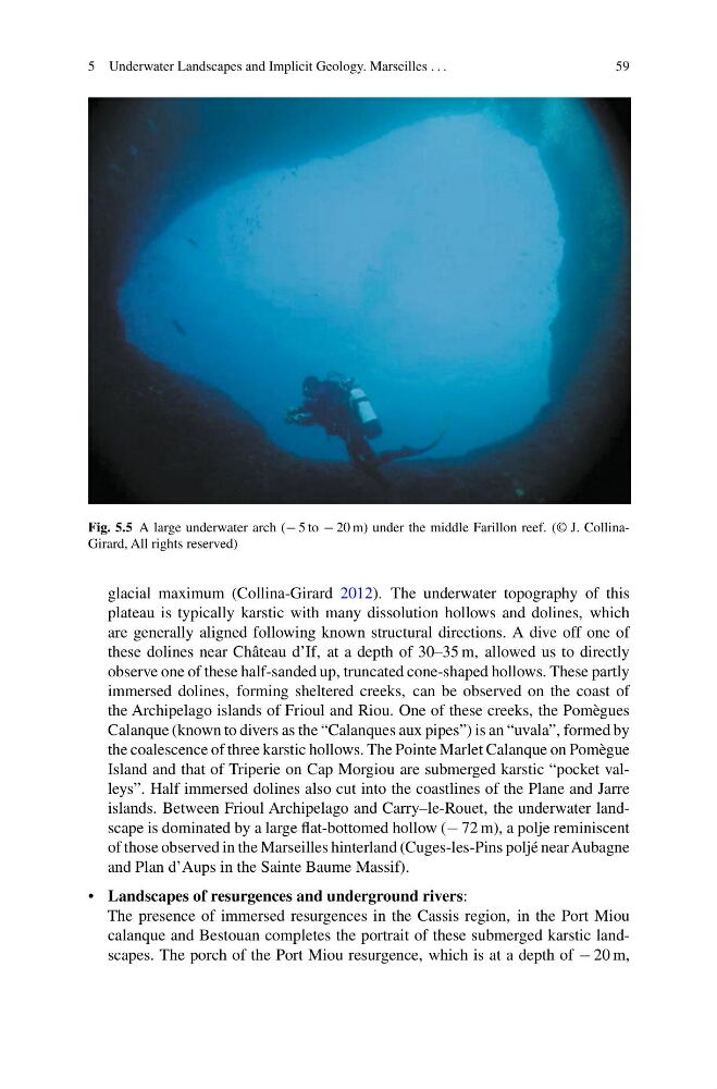
Fig. 5.5 A large underwater arch (− 5 to − 20 m) under the middle Farillon reef. (© J. CollinaGirard, All rights reserved)
glacial maximum (Collina-Girard 2012). The underwater topography of this
plateau is typically karstic with many dissolution hollows and dolines, which
are generally aligned following known structural directions. A dive off one of
these dolines near Château d’If, at a depth of 30–35 m, allowed us to directly
observe one of these half-sanded up, truncated cone-shaped hollows. These partly
immersed dolines, forming sheltered creeks, can be observed on the coast of
the Archipelago islands of Frioul and Riou. One of these creeks, the Pomègues
Calanque (known to divers as the “Calanques aux pipes”) is an “uvala”, formed by
the coalescence of three karstic hollows. The Pointe Marlet Calanque on Pomègue
Island and that of Triperie on Cap Morgiou are submerged karstic “pocket valleys”. Half immersed dolines also cut into the coastlines of the Plane and Jarre
islands. Between Frioul Archipelago and Carry–le-Rouet, the underwater landscape is dominated by a large flat-bottomed hollow (− 72 m), a polje reminiscent
of those observed in the Marseilles hinterland (Cuges-les-Pins poljé near Aubagne
and Plan d’Aups in the Sainte Baume Massif).
• Landscapes of resurgences and underground rivers:
The presence of immersed resurgences in the Cassis region, in the Port Miou
calanque and Bestouan completes the portrait of these submerged karstic landscapes. The porch of the Port Miou resurgence, which is at a depth of − 20 m,
59
Fig. 5.5 A large underwater arch (− 5 to − 20 m) under the middle Farillon reef. (© J. CollinaGirard, All rights reserved)
glacial maximum (Collina-Girard 2012). The underwater topography of this
plateau is typically karstic with many dissolution hollows and dolines, which
are generally aligned following known structural directions. A dive off one of
these dolines near Château d’If, at a depth of 30–35 m, allowed us to directly
observe one of these half-sanded up, truncated cone-shaped hollows. These partly
immersed dolines, forming sheltered creeks, can be observed on the coast of
the Archipelago islands of Frioul and Riou. One of these creeks, the Pomègues
Calanque (known to divers as the “Calanques aux pipes”) is an “uvala”, formed by
the coalescence of three karstic hollows. The Pointe Marlet Calanque on Pomègue
Island and that of Triperie on Cap Morgiou are submerged karstic “pocket valleys”. Half immersed dolines also cut into the coastlines of the Plane and Jarre
islands. Between Frioul Archipelago and Carry–le-Rouet, the underwater landscape is dominated by a large flat-bottomed hollow (− 72 m), a polje reminiscent
of those observed in the Marseilles hinterland (Cuges-les-Pins poljé near Aubagne
and Plan d’Aups in the Sainte Baume Massif).
• Landscapes of resurgences and underground rivers:
The presence of immersed resurgences in the Cassis region, in the Port Miou
calanque and Bestouan completes the portrait of these submerged karstic landscapes. The porch of the Port Miou resurgence, which is at a depth of − 20 m,