

18 The Seascape as an Indicator of Environmental Interest and Quality . . .
285
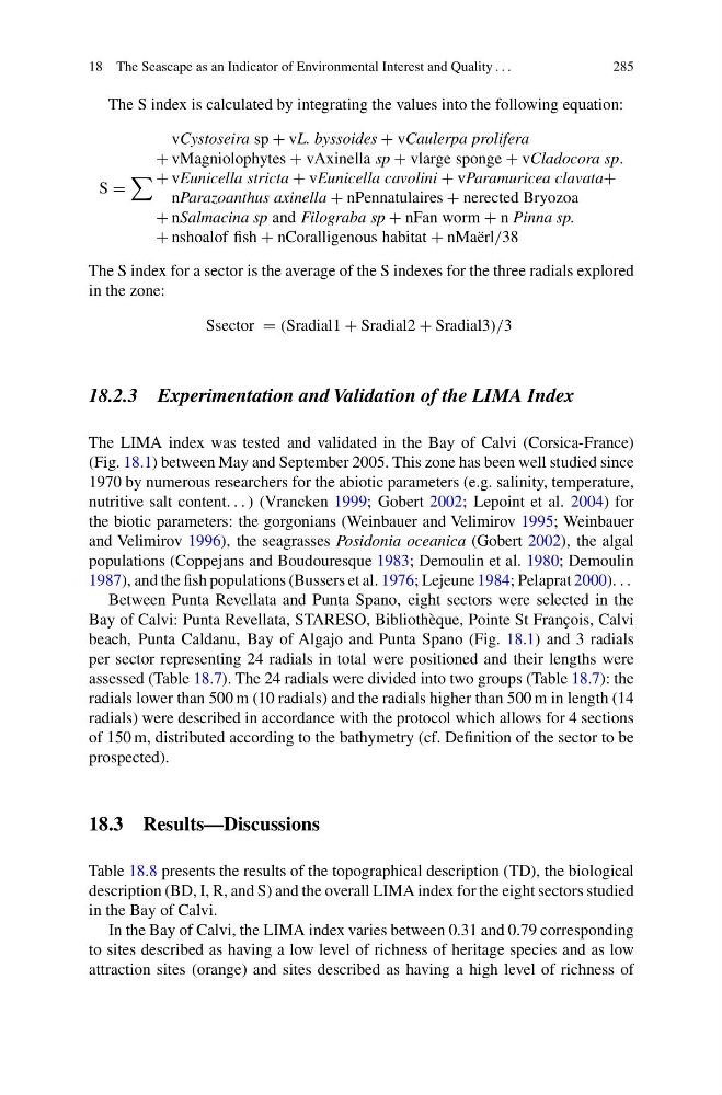
The S index is calculated by integrating the values into the following equation:
S =
vCystoseira sp + vL. byssoides + vCaulerpa prolifera
+ vMagniolophytes + vAxinella sp + vlarge sponge + vCladocora sp.
+ vEunicella stricta + vEunicella cavolini + vParamuricea clavata+
nParazoanthus axinella + nPennatulaires + nerected Bryozoa
+ nSalmacina sp and Filograba sp + nFan worm + n Pinna sp.
+ nshoalof fish + nCoralligenous habitat + nMaërl/38
The S index for a sector is the average of the S indexes for the three radials explored
in the zone:
Ssector = (Sradial1 + Sradial2 + Sradial3)/3
18.2.3 Experimentation and Validation of the LIMA Index
The LIMA index was tested and validated in the Bay of Calvi (Corsica-France)
(Fig. 18.1) between May and September 2005. This zone has been well studied since
1970 by numerous researchers for the abiotic parameters (e.g. salinity, temperature,
nutritive salt content. . . ) (Vrancken 1999; Gobert 2002; Lepoint et al. 2004) for
the biotic parameters: the gorgonians (Weinbauer and Velimirov 1995; Weinbauer
and Velimirov 1996), the seagrasses Posidonia oceanica (Gobert 2002), the algal
populations (Coppejans and Boudouresque 1983; Demoulin et al. 1980; Demoulin
1987), and the fish populations (Bussers et al. 1976; Lejeune 1984; Pelaprat 2000). . .
Between Punta Revellata and Punta Spano, eight sectors were selected in the
Bay of Calvi: Punta Revellata, STARESO, Bibliothèque, Pointe St François, Calvi
beach, Punta Caldanu, Bay of Algajo and Punta Spano (Fig. 18.1) and 3 radials
per sector representing 24 radials in total were positioned and their lengths were
assessed (Table 18.7). The 24 radials were divided into two groups (Table 18.7): the
radials lower than 500 m (10 radials) and the radials higher than 500 m in length (14
radials) were described in accordance with the protocol which allows for 4 sections
of 150 m, distributed according to the bathymetry (cf. Definition of the sector to be
prospected).
18.3 Results—Discussions
Table 18.8 presents the results of the topographical description (TD), the biological
description (BD, I, R, and S) and the overall LIMA index for the eight sectors studied
in the Bay of Calvi.
In the Bay of Calvi, the LIMA index varies between 0.31 and 0.79 corresponding
to sites described as having a low level of richness of heritage species and as low
attraction sites (orange) and sites described as having a high level of richness of
285
The S index is calculated by integrating the values into the following equation:
S =
vCystoseira sp + vL. byssoides + vCaulerpa prolifera
+ vMagniolophytes + vAxinella sp + vlarge sponge + vCladocora sp.
+ vEunicella stricta + vEunicella cavolini + vParamuricea clavata+
nParazoanthus axinella + nPennatulaires + nerected Bryozoa
+ nSalmacina sp and Filograba sp + nFan worm + n Pinna sp.
+ nshoalof fish + nCoralligenous habitat + nMaërl/38
The S index for a sector is the average of the S indexes for the three radials explored
in the zone:
Ssector = (Sradial1 + Sradial2 + Sradial3)/3
18.2.3 Experimentation and Validation of the LIMA Index
The LIMA index was tested and validated in the Bay of Calvi (Corsica-France)
(Fig. 18.1) between May and September 2005. This zone has been well studied since
1970 by numerous researchers for the abiotic parameters (e.g. salinity, temperature,
nutritive salt content. . . ) (Vrancken 1999; Gobert 2002; Lepoint et al. 2004) for
the biotic parameters: the gorgonians (Weinbauer and Velimirov 1995; Weinbauer
and Velimirov 1996), the seagrasses Posidonia oceanica (Gobert 2002), the algal
populations (Coppejans and Boudouresque 1983; Demoulin et al. 1980; Demoulin
1987), and the fish populations (Bussers et al. 1976; Lejeune 1984; Pelaprat 2000). . .
Between Punta Revellata and Punta Spano, eight sectors were selected in the
Bay of Calvi: Punta Revellata, STARESO, Bibliothèque, Pointe St François, Calvi
beach, Punta Caldanu, Bay of Algajo and Punta Spano (Fig. 18.1) and 3 radials
per sector representing 24 radials in total were positioned and their lengths were
assessed (Table 18.7). The 24 radials were divided into two groups (Table 18.7): the
radials lower than 500 m (10 radials) and the radials higher than 500 m in length (14
radials) were described in accordance with the protocol which allows for 4 sections
of 150 m, distributed according to the bathymetry (cf. Definition of the sector to be
prospected).
18.3 Results—Discussions
Table 18.8 presents the results of the topographical description (TD), the biological
description (BD, I, R, and S) and the overall LIMA index for the eight sectors studied
in the Bay of Calvi.
In the Bay of Calvi, the LIMA index varies between 0.31 and 0.79 corresponding
to sites described as having a low level of richness of heritage species and as low
attraction sites (orange) and sites described as having a high level of richness of