

252
A. Collin et al.
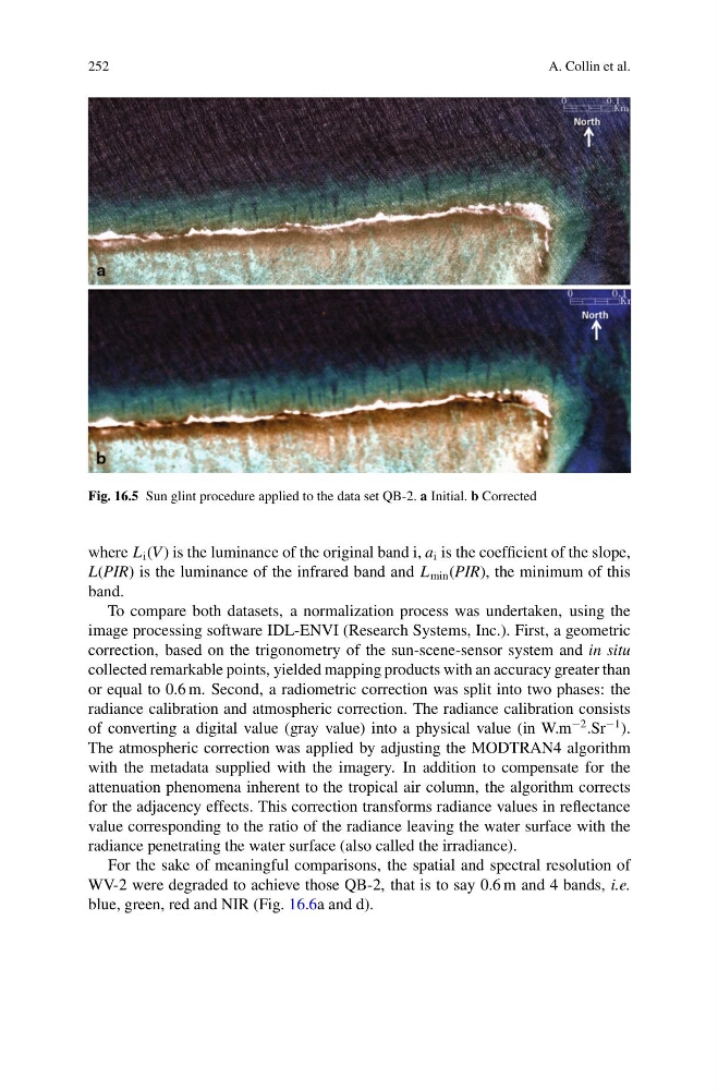
Fig. 16.5 Sun glint procedure applied to the data set QB-2. a Initial. b Corrected
where L i (V ) is the luminance of the original band i, a i is the coefficient of the slope,
L(PIR) is the luminance of the infrared band and L min (PIR), the minimum of this
band.
To compare both datasets, a normalization process was undertaken, using the
image processing software IDL-ENVI (Research Systems, Inc.). First, a geometric
correction, based on the trigonometry of the sun-scene-sensor system and in situ
collected remarkable points, yielded mapping products with an accuracy greater than
or equal to 0.6 m. Second, a radiometric correction was split into two phases: the
radiance calibration and atmospheric correction. The radiance calibration consists
of converting a digital value (gray value) into a physical value (in W.m
−2 .Sr
−1 ).
The atmospheric correction was applied by adjusting the MODTRAN4 algorithm
with the metadata supplied with the imagery. In addition to compensate for the
attenuation phenomena inherent to the tropical air column, the algorithm corrects
for the adjacency effects. This correction transforms radiance values in reflectance
value corresponding to the ratio of the radiance leaving the water surface with the
radiance penetrating the water surface (also called the irradiance).
For the sake of meaningful comparisons, the spatial and spectral resolution of
WV-2 were degraded to achieve those QB-2, that is to say 0.6 m and 4 bands, i.e.
blue, green, red and NIR (Fig. 16.6a and d).
A. Collin et al.
Fig. 16.5 Sun glint procedure applied to the data set QB-2. a Initial. b Corrected
where L i (V ) is the luminance of the original band i, a i is the coefficient of the slope,
L(PIR) is the luminance of the infrared band and L min (PIR), the minimum of this
band.
To compare both datasets, a normalization process was undertaken, using the
image processing software IDL-ENVI (Research Systems, Inc.). First, a geometric
correction, based on the trigonometry of the sun-scene-sensor system and in situ
collected remarkable points, yielded mapping products with an accuracy greater than
or equal to 0.6 m. Second, a radiometric correction was split into two phases: the
radiance calibration and atmospheric correction. The radiance calibration consists
of converting a digital value (gray value) into a physical value (in W.m
−2 .Sr
−1 ).
The atmospheric correction was applied by adjusting the MODTRAN4 algorithm
with the metadata supplied with the imagery. In addition to compensate for the
attenuation phenomena inherent to the tropical air column, the algorithm corrects
for the adjacency effects. This correction transforms radiance values in reflectance
value corresponding to the ratio of the radiance leaving the water surface with the
radiance penetrating the water surface (also called the irradiance).
For the sake of meaningful comparisons, the spatial and spectral resolution of
WV-2 were degraded to achieve those QB-2, that is to say 0.6 m and 4 bands, i.e.
blue, green, red and NIR (Fig. 16.6a and d).