

15 Application of the Multi-sensor Fusion Method for Underwater Landscape Modeling
243
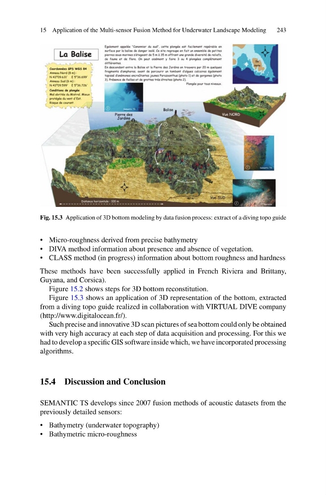
Fig. 15.3 Application of 3D bottom modeling by data fusion process: extract of a diving topo guide
• Micro-roughness derived from precise bathymetry
• DIVA method information about presence and absence of vegetation.
• CLASS method (in progress) information about bottom roughness and hardness
These methods have been successfully applied in French Riviera and Brittany,
Guyana, and Corsica).
Figure 15.2 shows steps for 3D bottom reconstitution.
Figure 15.3 shows an application of 3D representation of the bottom, extracted
from a diving topo guide realized in collaboration with VIRTUAL DIVE company
(http://www.digitalocean.fr/).
Such precise and innovative 3D scan pictures of sea bottom could only be obtained
with very high accuracy at each step of data acquisition and processing. For this we
had to develop a specific GIS software inside which, we have incorporated processing
algorithms.
15.4 Discussion and Conclusion
SEMANTIC TS develops since 2007 fusion methods of acoustic datasets from the
previously detailed sensors:
• Bathymetry (underwater topography)
• Bathymetric micro-roughness
243
Fig. 15.3 Application of 3D bottom modeling by data fusion process: extract of a diving topo guide
• Micro-roughness derived from precise bathymetry
• DIVA method information about presence and absence of vegetation.
• CLASS method (in progress) information about bottom roughness and hardness
These methods have been successfully applied in French Riviera and Brittany,
Guyana, and Corsica).
Figure 15.2 shows steps for 3D bottom reconstitution.
Figure 15.3 shows an application of 3D representation of the bottom, extracted
from a diving topo guide realized in collaboration with VIRTUAL DIVE company
(http://www.digitalocean.fr/).
Such precise and innovative 3D scan pictures of sea bottom could only be obtained
with very high accuracy at each step of data acquisition and processing. For this we
had to develop a specific GIS software inside which, we have incorporated processing
algorithms.
15.4 Discussion and Conclusion
SEMANTIC TS develops since 2007 fusion methods of acoustic datasets from the
previously detailed sensors:
• Bathymetry (underwater topography)
• Bathymetric micro-roughness