

242
C. Noël et al.
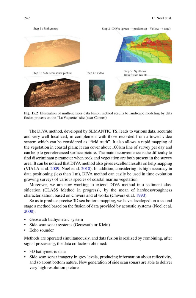
Step 1 : Bathymetry
Step 4 : video
Step 5 : Synthesis
Data fusion results
Step 2 : DIVA (green → posidonia) – Yellow → sand)
Step 3 : Side scan sonar picture
Fig. 15.2 Illustration of multi-sensors data fusion method results to landscape modeling by data
fusion process on the “La Vaquette” site (near Cannes)
The DIVA method, developed by SEMANTIC TS, leads to various data, accurate
and very well localized, in complement with those recorded from a towed video
system which can be considered as “field truth”. It also allows a rapid mapping of
the vegetation in coastal plain; it can cover about 100 km line of survey per day and
can help to georeferenced surface picture. The main inconvenience is the difficulty to
find discriminant parameter when rock and vegetation are both present in the survey
area. It can be noticed that DIVA method also gives excellent results on kelp mapping
(VIALA et al. 2009; Noel et al. 2010). In addition, considering its high accuracy in
data positioning (less than 1 m), DIVA method can easily be used in time evolution
growing surveys of various species of coastal marine vegetation.
Moreover, we are now working to extend DIVA method into sediment classification (CLASS Method in progress), by the mean of hardness/roughness
characterization, based on Chivers and al works (Chivers et al. 1990).
So as to produce precise 3D sea bottom mapping, we have developed on a second
stage a method based on the fusion of data provided by acoustic systems (Noël et al.
2008):
• Geoswath bathymetric system
• Side scan sonar systems (Geoswath or Klein)
• Echo sounder
Methods are operated simultaneously, and data fusion is realized by combining, after
signal processing, the data collection obtained:
• 3D bathymetric data
• Side scan sonar imagery in grey levels, producing information about reflectivity,
and so about bottom nature. New generation of side scan sonars are able to deliver
very high resolution picture
C. Noël et al.
Step 1 : Bathymetry
Step 4 : video
Step 5 : Synthesis
Data fusion results
Step 2 : DIVA (green → posidonia) – Yellow → sand)
Step 3 : Side scan sonar picture
Fig. 15.2 Illustration of multi-sensors data fusion method results to landscape modeling by data
fusion process on the “La Vaquette” site (near Cannes)
The DIVA method, developed by SEMANTIC TS, leads to various data, accurate
and very well localized, in complement with those recorded from a towed video
system which can be considered as “field truth”. It also allows a rapid mapping of
the vegetation in coastal plain; it can cover about 100 km line of survey per day and
can help to georeferenced surface picture. The main inconvenience is the difficulty to
find discriminant parameter when rock and vegetation are both present in the survey
area. It can be noticed that DIVA method also gives excellent results on kelp mapping
(VIALA et al. 2009; Noel et al. 2010). In addition, considering its high accuracy in
data positioning (less than 1 m), DIVA method can easily be used in time evolution
growing surveys of various species of coastal marine vegetation.
Moreover, we are now working to extend DIVA method into sediment classification (CLASS Method in progress), by the mean of hardness/roughness
characterization, based on Chivers and al works (Chivers et al. 1990).
So as to produce precise 3D sea bottom mapping, we have developed on a second
stage a method based on the fusion of data provided by acoustic systems (Noël et al.
2008):
• Geoswath bathymetric system
• Side scan sonar systems (Geoswath or Klein)
• Echo sounder
Methods are operated simultaneously, and data fusion is realized by combining, after
signal processing, the data collection obtained:
• 3D bathymetric data
• Side scan sonar imagery in grey levels, producing information about reflectivity,
and so about bottom nature. New generation of side scan sonars are able to deliver
very high resolution picture