

14 Underwater Multimodal Survey: Merging Optical and Acoustic Data
233
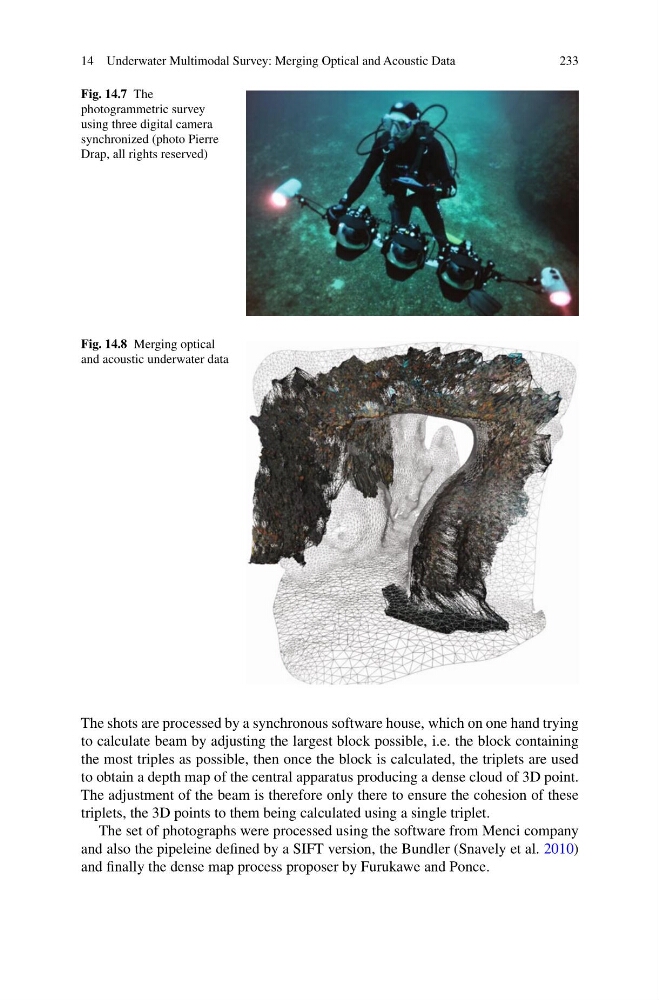
Fig. 14.7 The
photogrammetric survey
using three digital camera
synchronized (photo Pierre
Drap, all rights reserved)
Fig. 14.8 Merging optical
and acoustic underwater data
The shots are processed by a synchronous software house, which on one hand trying
to calculate beam by adjusting the largest block possible, i.e. the block containing
the most triples as possible, then once the block is calculated, the triplets are used
to obtain a depth map of the central apparatus producing a dense cloud of 3D point.
The adjustment of the beam is therefore only there to ensure the cohesion of these
triplets, the 3D points to them being calculated using a single triplet.
The set of photographs were processed using the software from Menci company
and also the pipeleine defined by a SIFT version, the Bundler (Snavely et al. 2010)
and finally the dense map process proposer by Furukawe and Ponce.
233
Fig. 14.7 The
photogrammetric survey
using three digital camera
synchronized (photo Pierre
Drap, all rights reserved)
Fig. 14.8 Merging optical
and acoustic underwater data
The shots are processed by a synchronous software house, which on one hand trying
to calculate beam by adjusting the largest block possible, i.e. the block containing
the most triples as possible, then once the block is calculated, the triplets are used
to obtain a depth map of the central apparatus producing a dense cloud of 3D point.
The adjustment of the beam is therefore only there to ensure the cohesion of these
triplets, the 3D points to them being calculated using a single triplet.
The set of photographs were processed using the software from Menci company
and also the pipeleine defined by a SIFT version, the Bundler (Snavely et al. 2010)
and finally the dense map process proposer by Furukawe and Ponce.