

626
Susan S. Bell, Mark S. Fonseca, and Nathaniel B. Stafford
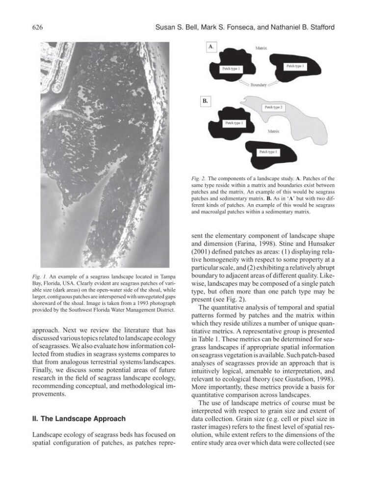
Fig. 1. An example of a seagrass landscape located in Tampa
Bay, Florida, USA. Clearly evident are seagrass patches of variable size (dark areas) on the open-water side of the shoal, while
larger, contiguous patches are interspersed with unvegetated gaps
shoreward of the shoal. Image is taken from a 1993 photograph
provided by the Southwest Florida Water Management District.
approach. Next we review the literature that has
discussed various topics related to landscape ecology
of seagrasses. We also evaluate how information collected from studies in seagrass systems compares to
that from analogous terrestrial systems/landscapes.
Finally, we discuss some potential areas of future
research in the field of seagrass landscape ecology,
recommending conceptual, and methodological improvements.
II. The Landscape Approach
Landscape ecology of seagrass beds has focused on
spatial configuration of patches, as patches repreFig. 2. The components of a landscape study. A. Patches of the
same type reside within a matrix and boundaries exist between
patches and the matrix. An example of this would be seagrass
patches and sedimentary matrix. B. As in ‘A’ but with two different kinds of patches. An example of this would be seagrass
and macroalgal patches within a sedimentary matrix.
sent the elementary component of landscape shape
and dimension (Farina, 1998). Stine and Hunsaker
(2001) defined patches as areas: (1) displaying relative homogeneity with respect to some property at a
particular scale, and (2) exhibiting a relatively abrupt
boundary to adjacent areas of different quality. Likewise, landscapes may be composed of a single patch
type, but often more than one patch type may be
present (see Fig. 2).
The quantitative analysis of temporal and spatial
patterns formed by patches and the matrix within
which they reside utilizes a number of unique quantitative metrics. A representative group is presented
in Table 1. These metrics can be determined for seagrass landscapes if appropriate spatial information
on seagrass vegetation is available. Such patch-based
analyses of seagrasses provide an approach that is
intuitively logical, amenable to interpretation, and
relevant to ecological theory (see Gustafson, 1998).
More importantly, these metrics provide a basis for
quantitative comparison across landscapes.
The use of landscape metrics of course must be
interpreted with respect to grain size and extent of
data collection. Grain size (e.g. cell or pixel size in
raster images) refers to the finest level of spatial resolution, while extent refers to the dimensions of the
entire study area over which data were collected (see