

Portugal
287
eutrophication have not yet been detected. Although there is evidence
that nitrogen is the limiting nutrient to phytoplankton productivity
along the estuary, the Alcacer zone presents higher nutrient levels in
winter (N0 3 - -N up to 96 11M, NH4+ -N up to 7.0 11M, PO~- -P up to 1.7 11M
and Si0 2 up to 160 11M) and is more productive (chI a up to
33.1 mg m -3) compared to the main body and the Marateca bay (N0 3 --N
up to 21 11M, NH4+ -N up to 6.5 11M, PO~·- -P up to 1.5 11M and Si0 2 up to
52 11M and chI a up to 14.3 mg m -3; Cabe<;adas and Brogueira 1991).
11.2.3 Ria Formosa Lagoon
The Ria Formosa is a shallow lagoonal system extending more
than 50 km along the southern coast of Portugal. The lagoon is permanently connected to the sea through several narrow channels, the most
important being the Barra de S. Luiz, Barra de Faro-Olhao, Barra Grande
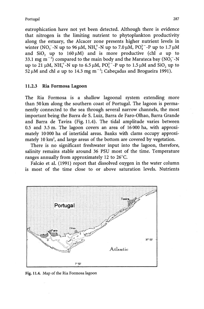
and Barra de Tavira (Fig. 11.4). The tidal amplitude varies between
0.5 and 3.5 m. The lagoon covers an area of 16000 ha, with approximately 10 000 ha of intertidal areas. Banks with clams occupy approximately 10 km 2 , and large areas of the bottom are covered by vegetation.
There is no significant freshwater input into the lagoon, therefore,
salinity remains stable around 36 PSU most of the time. Temperature
ranges annually from approximately 12 to 26°C.
Falcao et al. (1991) report that dissolved oxygen in the water column
is most of the time close to or above saturation levels. Nutrients
...............
.. :::::::::;:::::::::::::::::::::::::::-.
:.::::::"""' ::"
...... :::::::::::::::::::::::::::::1::::::::::::~~·
37"00'
AtfJ"'l1llhic
Fig. 11.4. Map of the Ria Formosa lagoon
287
eutrophication have not yet been detected. Although there is evidence
that nitrogen is the limiting nutrient to phytoplankton productivity
along the estuary, the Alcacer zone presents higher nutrient levels in
winter (N0 3 - -N up to 96 11M, NH4+ -N up to 7.0 11M, PO~- -P up to 1.7 11M
and Si0 2 up to 160 11M) and is more productive (chI a up to
33.1 mg m -3) compared to the main body and the Marateca bay (N0 3 --N
up to 21 11M, NH4+ -N up to 6.5 11M, PO~·- -P up to 1.5 11M and Si0 2 up to
52 11M and chI a up to 14.3 mg m -3; Cabe<;adas and Brogueira 1991).
11.2.3 Ria Formosa Lagoon
The Ria Formosa is a shallow lagoonal system extending more
than 50 km along the southern coast of Portugal. The lagoon is permanently connected to the sea through several narrow channels, the most
important being the Barra de S. Luiz, Barra de Faro-Olhao, Barra Grande
and Barra de Tavira (Fig. 11.4). The tidal amplitude varies between
0.5 and 3.5 m. The lagoon covers an area of 16000 ha, with approximately 10 000 ha of intertidal areas. Banks with clams occupy approximately 10 km 2 , and large areas of the bottom are covered by vegetation.
There is no significant freshwater input into the lagoon, therefore,
salinity remains stable around 36 PSU most of the time. Temperature
ranges annually from approximately 12 to 26°C.
Falcao et al. (1991) report that dissolved oxygen in the water column
is most of the time close to or above saturation levels. Nutrients
...............
.. :::::::::;:::::::::::::::::::::::::::-.
:.::::::"""' ::"
...... :::::::::::::::::::::::::::::1::::::::::::~~·
37"00'
AtfJ"'l1llhic
Fig. 11.4. Map of the Ria Formosa lagoon