

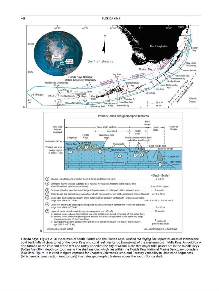
Florida Keys, Figure 2 (a) Index map of south Florida and the Florida Keys. Dashed red dogleg line separates areas of Pleistocene
ooid bank (Miami Limestone) of the lower Keys and coral reef (Key Largo Limestone) of the westernmost middle Keys. An ooid bank
also formed at the east end of the reef and today underlies the city of Miami. Note that major tidal passes are in the middle Keys.
Dotted line (30-m depth contour) marks the shelf margin, which lies within the Florida Keys National Marine Sanctuary boundary
(blue line). Figure 1a is cited in figure captions for Chapters Calcrete/Caliche, and Porosity Variability in Limestone Sequences.
(b) Schematic cross section (not to scale) illustrates geomorphic features across the south Florida shelf.
408
FLORIDA KEYS
ooid bank (Miami Limestone) of the lower Keys and coral reef (Key Largo Limestone) of the westernmost middle Keys. An ooid bank
also formed at the east end of the reef and today underlies the city of Miami. Note that major tidal passes are in the middle Keys.
Dotted line (30-m depth contour) marks the shelf margin, which lies within the Florida Keys National Marine Sanctuary boundary
(blue line). Figure 1a is cited in figure captions for Chapters Calcrete/Caliche, and Porosity Variability in Limestone Sequences.
(b) Schematic cross section (not to scale) illustrates geomorphic features across the south Florida shelf.
408
FLORIDA KEYS