

to measure water clarity is an electronic turbidimeter,
recorded in formazin turbidity units (FTU) or nephelometric turbidity units (NTU) (Figure 3). This instrument measures the amount of light scattering that occurs within
a given water sample by shining a bright light on one side
of the sample and measuring the amount redirected to the
detector located 90
to the incident light (direction of the
incoming light). Scattering from the water sample is measured relative to the amount of light scattered by
a reference solution (a solution that will cause a known
amount of light scattering; Davies-Colley, 1990; DaviesColley and Smith 2001). At larger scales, remote
sensing-based methods are well suited for monitoring clarity in water bodies such as inland lakes, rivers, and estuaries (Woodruff et al., 1999; Kilham et al. 2012). Robust
water clarity estimates can be derived using MODIS
(or Moderate Resolution Imaging Spectroradiometer),
a key and commonly used instrument combined with
field-collected Secchi disk transparency data to estimate
water clarity. The use of remote sensing data combined
with transparency data is an effective tool for measuring
changes in water clarity throughout the growing season
(Knight and Voth, 2012).
Bibliography
Davies-Colley, R. J., 1990. Secchi disc transparency and turbidity:
discussion. Journal of Environmental Engineering Division
ASCE, 114, 796–798.
Davies-Colley, R. J., and Smith, D. G., 2001. Turbidity, suspended
sediment, and water clarity: a review. Journal of the American
Water Resources Association, 37, 1085–1101.
Kilham, N. E., Roberts, D., and Singer, M. B., 2012. Remote
sensing of suspended sediment concentration during turbid
flood conditions on the Feather River, California – a modeling
approach. Water Resources Research, 48, W01521,
doi:10.1029/2011WR010391
Knight, J. F., and Voth, M. L., 2012. Application of MODIS Imagery for intra-annual water clarity assessment of Minnesota lakes.
Remote Sensing, 4, 2181–2198.
Woodruff, D. L., Stumpf, R. P., Scope, J. A., and Paerl, H. W., 1999.
Estimation of water clarity in optically complex estuarine waters.
Remote Sensing of the Environment, 68, 41–52.
Cross-references
Secchi Disk
Turbidity
WATER QUALITY
Melanie D. Harrison
Water Quality Specialist, National Oceanic and
Atmospheric Administration, Santa Rosa, CA, USA
Definition
Water quality is broadly defined as the physical, chemical,
and biological composition of water as related to its
intended use for such purposes as drinking, recreation,
health of ecosystems, and safety of human health
(Veatch and Humphrys, 1966; Richard and McQuisten,
1968; APHA, 1969). The term can be applied to a single
characteristic of water or to a group of characteristics combined into a water quality index.
Impacts to water quality
Anthropogenic impacts coupled to urbanization as well as
agricultural, commercial, and industrial uses greatly affect
the water quality of lakes, streams, rivers, inland bays, and
coastal estuaries. These changes in land use increase
pollutant loads (e.g., pesticides, nutrients, sediments, trace
metals, and volatile organic carbons) and have adverse
effects on water quality in the environment (Gilliom
et al., 2006; Horowtiz and Stephens, 2008; Spargue
et al., 2009; Dubrovsky et al., 2010). Coastal estuaries
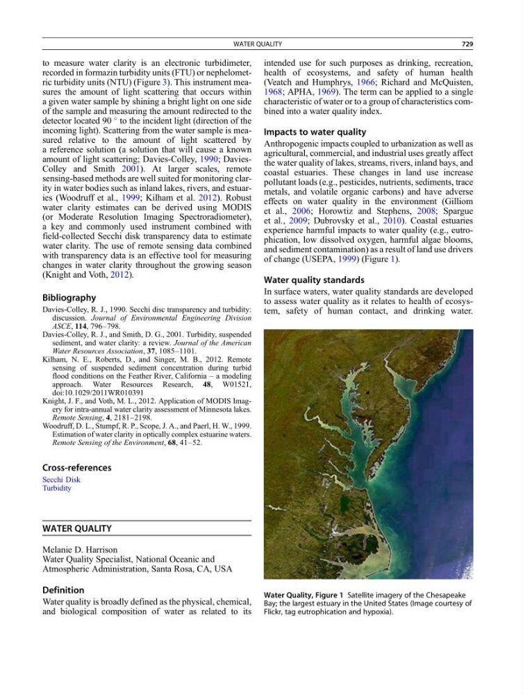
experience harmful impacts to water quality (e.g., eutrophication, low dissolved oxygen, harmful algae blooms,
and sediment contamination) as a result of land use drivers
of change (USEPA, 1999) (Figure 1).
Water quality standards
In surface waters, water quality standards are developed
to assess water quality as it relates to health of ecosystem, safety of human contact, and drinking water.
Water Quality, Figure 1 Satellite imagery of the Chesapeake
Bay; the largest estuary in the United States (Image courtesy of
Flickr, tag eutrophication and hypoxia).
WATER QUALITY
729