

located in seaward parts of an estuary tend to be more saline
in groundwater and pellicular water than those located in
the riverine parts; (2) location on the tidal flat relative to
MSL; (3) the stage of the tidal cycle in terms of spring tide
versus neap tide, and rising tidal water versus falling tidal
water; (4) the length of exposure of the tidal flat within
the tidal cycle or between spring tides and neap tide phases;
and (5) the climate, which determines the extent of evaporation, the influence of rainfall on the tidal flat, and the
development of mangroves and saltmarsh. The salinity of
the tidal flat groundwater tends to be relatively constant
from tide to tide during a given season and can even be constant over the entire year. Transpiration by tidal flat vegetation increases baseline salinities of pellicular and
groundwaters.
While there may be a general trend of increasing tidal
flat salinity from low tidal levels to the high tide mark, this
can be reversed by freshwater seepage along the margin of
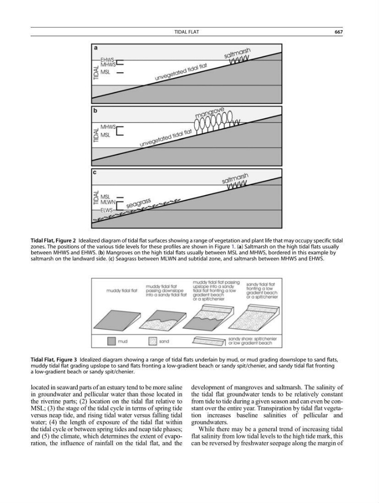
Tidal Flat, Figure 3 Idealized diagram showing a range of tidal flats underlain by mud, or mud grading downslope to sand flats,
muddy tidal flat grading upslope to sand flats fronting a low-gradient beach or sandy spit/chenier, and sandy tidal flat fronting
a low-gradient beach or sandy spit/chenier.
Tidal Flat, Figure 2 Idealized diagram of tidal flat surfaces showing a range of vegetation and plant life that may occupy specific tidal
zones. The positions of the various tide levels for these profiles are shown in Figure 1. (a) Saltmarsh on the high tidal flats usually
between MHWS and EHWS. (b) Mangroves on the high tidal flats usually between MSL and MHWS, bordered in this example by
saltmarsh on the landward side. (c) Seagrass between MLWN and subtidal zone, and saltmarsh between MHWS and EHWS.
TIDAL FLAT
667