

study of the sedimentary dynamics in estuaries and coastal
marine areas. The use of side-scan sonar is vital in estuarine research because it allows the rapid scanning of large
areas of the estuarine floor to yield images or records for
interpretation of the beds.
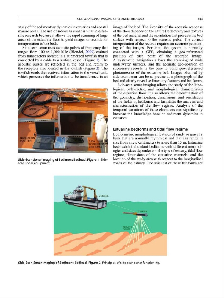
Side-scan sonar uses acoustic pulses of frequency that
ranges from 100 to 1,000 kHz (Blondel, 2009) emitted
from transductors located in a submerged towfish that is
connected by a cable to a surface vessel (Figure 1). The
acoustic pulses are reflected in the bed and return to
the receptors also located in the towfish (Figure 2). The
towfish sends the received information to the vessel unit,
which processes the information to be transformed in an
image of the bed. The intensity of the acoustic response
of the floor depends on the nature (reflectivity and texture)
of the bed material and the orientation that presents the bed
surface with respect to the acoustic pulse. The correct
interpretation of the records requires an accurate positioning of the images. For that, the system is normally
connected with a GPS, obtaining a geo-referenced
position of each point of the recorded image.
A systematic navigation allows the scanning of wide
underwater surfaces, and the accurate geo-position of
successive records is the base to build geo-referenced
photomosaics of the estuarine bed. Images obtained by
side-scan sonar can be as precise as a photograph of the
bed and clearly reveal sedimentary features and bedforms.
Side-scan sonar imaging allows the study of the lithological, bathymetric, and morphological characteristics
of the estuarine floor. It also allows the determination of
the geometry, distribution, dimensions, and orientation
of the fields of bedforms and facilitates the analysis and
characterization of the flow regime. Analysis of the
temporal variations of these characters can significantly
increase the knowledge base on sediment dynamics in
estuaries.
Estuarine bedforms and tidal flow regime
Bedforms are morphological features of sandy or gravelly
beds that are normally rhythmical and that can range in
size from a few centimeters to more than 15 m. Estuarine
beds exhibit abundant bedforms with different morphologies and sizes dependent on the type of estuary, tidal flow
regime, dimensions of the estuarine channels, and the
location of the study area with respect to the longitudinal
zones of the estuary. The smallest of these bedforms are
Side-Scan Sonar Imaging of Sediment Bedload, Figure 1 Sidescan sonar equipment.
Side-Scan Sonar Imaging of Sediment Bedload, Figure 2 Principles of side-scan sonar functioning.
SIDE-SCAN SONAR IMAGING OF SEDIMENT BEDLOAD
603