

dry beach width as the horizontal distance between the
mean high water (MHW) shoreline and the landward
boundary or base reference line. The MHW shoreline is
employed because it commonly is the land/water boundary shoreline on maps, is more readily identified from
aerial photos, and is a more conservative, minimum width
(and volume) for shore protection. It is the minimum
dry beach width required to protect the foredune, cliff,
structure or vegetation under normal storm conditions.
According to the CEM, the beach does the work and its
resilience and recovery are critical for long-term shore
protection.
Silvester and Hsu (1993) define dynamic equilibrium
as sand transport through an embayed coast so long as
the upcoast supply of sand remains constant. If the sand -
supply is reduced over a reasonable length of time, the
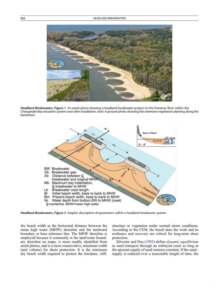
Headland Breakwaters, Figure 2 Graphic description of parameters within a headland breakwater system.
Headland Breakwaters, Figure 1 An aerial photo showing a headland breakwater project on the Potomac River within the
Chesapeake Bay estuarine system soon after installation. Inset: A ground photo showing the extensive vegetation planting along the
backshore.
352
HEADLAND BREAKWATERS
mean high water (MHW) shoreline and the landward
boundary or base reference line. The MHW shoreline is
employed because it commonly is the land/water boundary shoreline on maps, is more readily identified from
aerial photos, and is a more conservative, minimum width
(and volume) for shore protection. It is the minimum
dry beach width required to protect the foredune, cliff,
structure or vegetation under normal storm conditions.
According to the CEM, the beach does the work and its
resilience and recovery are critical for long-term shore
protection.
Silvester and Hsu (1993) define dynamic equilibrium
as sand transport through an embayed coast so long as
the upcoast supply of sand remains constant. If the sand -
supply is reduced over a reasonable length of time, the
Headland Breakwaters, Figure 2 Graphic description of parameters within a headland breakwater system.
Headland Breakwaters, Figure 1 An aerial photo showing a headland breakwater project on the Potomac River within the
Chesapeake Bay estuarine system soon after installation. Inset: A ground photo showing the extensive vegetation planting along the
backshore.
352
HEADLAND BREAKWATERS