

712
of New Brunswick to the research team. The long-term monitoring continues to be
supported by the NB Environmental Trust Fund, DUC, MITACS, University of New
Brunswick, and Mount Allison University.
21.3.3 Site Design
The team charged with designing the dike openings followed a process similar to
that outlined by Coats et al. (1989). The design had to satisfy a number of competing criteria. Specifically, the restoration cells were to be designed to:
• fully flood at high tide (i.e., the water level in the Bay and cells should be equal);
• drain slowly to maximize the opportunity for sediment deposition; and
• minimize wave impact on the new agricultural dike.
It was also necessary to find a design that did not result in water flow speeds
through the openings that would exceed the threshold for erosion. It was important
that the openings maintain their geometry for as long as possible (to meet the other
criteria outlined above). The main goal here was to maximize sediment deposition
to build up the elevation in the cells so that salt marsh could begin to re-establish; in
other words, a geomorphic foundation needed to be laid for the restoration of ecosystem services. Before the openings were excavated, the ground within the restoration cells was below that of the East reference marsh by up to 2.1 m.
To prevent the blue clay floors of the dike openings from eroding, as a result of
tidal flow through the openings, flow speeds needed to be kept below 1.5 m/s, which
is the approximate threshold for erosion at the clay/silt boundary (see the Hjulström
diagram; e.g., Figure 10.12 in Trenhaile 2016). Blue clay is a relatively uniform
clay with very low permeability and occasional sand pockets and/or cobbles
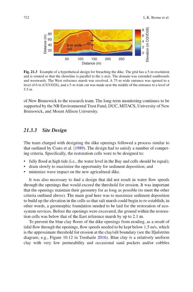
Fig. 21.3 Example of a hypothetical design for breaching the dike. The grid has a 5-m resolution
and is rotated so that the shoreline is parallel to the x-axis. The domain was extended southwards
and westwards. The West reference marsh was resolved. A 75-m wide entrance was opened to a
level of 6 m (CGVD28), and a 5-m wide cut was made near the middle of the entrance to a level of
5.5 m
L.K. Boone et al.