

638
and shellfish, which are commonly caught by several extractive activities of traditional communities inhabiting the islands of the Delta.
20.2.2 Goiana River Estuary
The Goiana River Estuary (Pernambuco and Paraíba States) is also located in the
eastern coast of South America (Northeast Brazil). The Atlantic Rain forest extends
only a couple hundred kilometres landwards, and separates the humid coast from
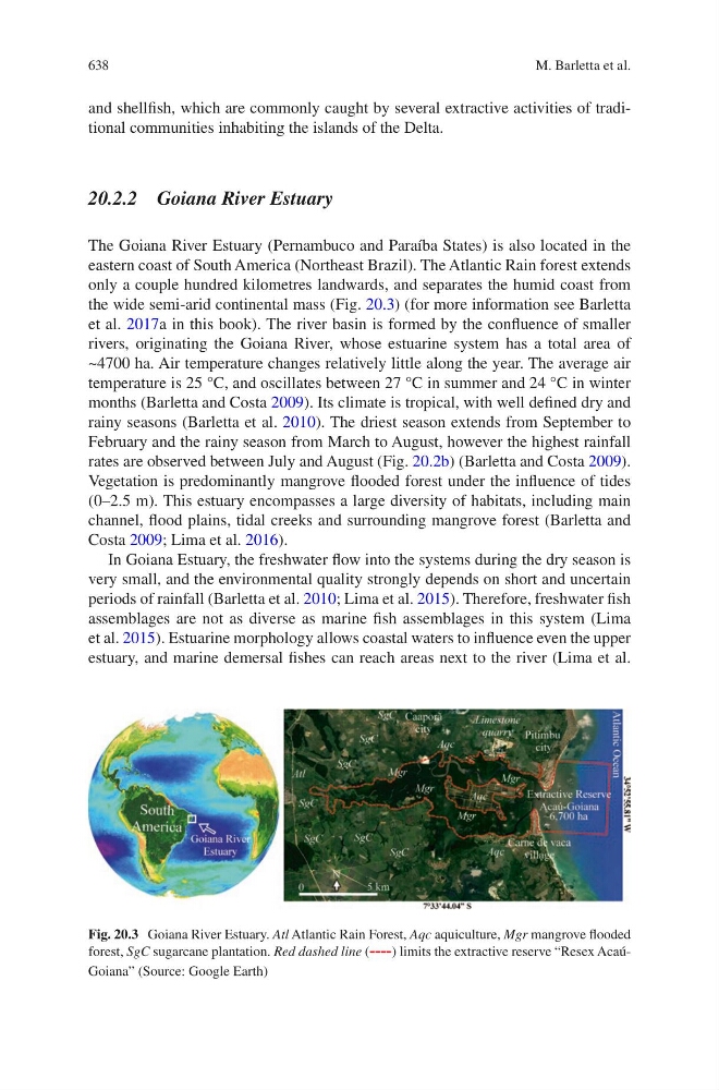
the wide semi-arid continental mass (Fig. 20.3) (for more information see Barletta
et al. 2017a in this book). The river basin is formed by the confluence of smaller
rivers, originating the Goiana River, whose estuarine system has a total area of
~4700 ha. Air temperature changes relatively little along the year. The average air
temperature is 25 °C, and oscillates between 27 °C in summer and 24 °C in winter
months (Barletta and Costa 2009). Its climate is tropical, with well defined dry and
rainy seasons (Barletta et al. 2010). The driest season extends from September to
February and the rainy season from March to August, however the highest rainfall
rates are observed between July and August (Fig. 20.2b) (Barletta and Costa 2009).
Vegetation is predominantly mangrove flooded forest under the influence of tides
(0–2.5 m). This estuary encompasses a large diversity of habitats, including main
channel, flood plains, tidal creeks and surrounding mangrove forest (Barletta and
Costa 2009; Lima et al. 2016).
In Goiana Estuary, the freshwater flow into the systems during the dry season is
very small, and the environmental quality strongly depends on short and uncertain
periods of rainfall (Barletta et al. 2010; Lima et al. 2015). Therefore, freshwater fish
assemblages are not as diverse as marine fish assemblages in this system (Lima
et al. 2015). Estuarine morphology allows coastal waters to influence even the upper
estuary, and marine demersal fishes can reach areas next to the river (Lima et al.
Fig. 20.3 Goiana River Estuary. Atl Atlantic Rain Forest, Aqc aquiculture, Mgr mangrove flooded
forest, SgC sugarcane plantation. Red dashed line (----) limits the extractive reserve “Resex AcaúGoiana” (Source: Google Earth)
M. Barletta et al.