

636
W), all located along the Western Atlantic coast of South America. The aim of this
chapter is to relate key environmental factors and man-driven changes for each estuary with the variation in the catches of the main landed fishery resources. Finally,
we propose improvements to managerial plans by linking science-based ecological
information to possible future accurate landing stats.
20.2 Study Areas and Natural Featurings
20.2.1 Parnaíba River Delta
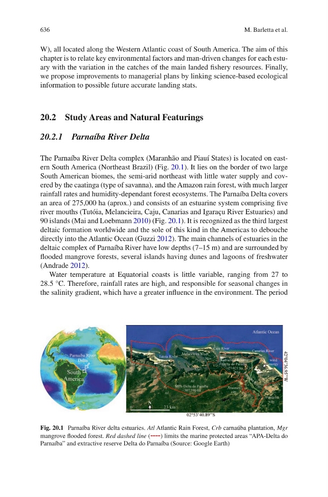
The Parnaíba River Delta complex (Maranhão and Piauí States) is located on eastern South America (Northeast Brazil) (Fig. 20.1). It lies on the border of two large
South American biomes, the semi-arid northeast with little water supply and covered by the caatinga (type of savanna), and the Amazon rain forest, with much larger
rainfall rates and humidity-dependant forest ecosystems. The Parnaíba Delta covers
an area of 275,000 ha (aprox.) and consists of an estuarine system comprising five
river mouths (Tutóia, Melancieira, Caju, Canarias and Igaraçu River Estuaries) and
90 islands (Mai and Loebmann 2010) (Fig. 20.1). It is recognized as the third largest
deltaic formation worldwide and the sole of this kind in the Americas to debouche
directly into the Atlantic Ocean (Guzzi 2012). The main channels of estuaries in the
deltaic complex of Parnaíba River have low depths (7–15 m) and are surrounded by
flooded mangrove forests, several islands having dunes and lagoons of freshwater
(Andrade 2012).
Water temperature at Equatorial coasts is little variable, ranging from 27 to
28.5 °C. Therefore, rainfall rates are high, and responsible for seasonal changes in
the salinity gradient, which have a greater influence in the environment. The period
Fig. 20.1 Parnaíba River delta estuaries. Atl Atlantic Rain Forest, Crb carnaúba plantation, Mgr
mangrove flooded forest. Red dashed line (----) limits the marine protected areas “APA-Delta do
Parnaíba” and extractive reserve Delta do Parnaíba (Source: Google Earth)
M. Barletta et al.