

604
Indus is 21st largest river of the world in terms of annual flow. It covers a distance
of 2880 km before draining in to the Arabian Sea. It forms a huge triangular fanshaped delta covering an area of about 6000 km
2
and comprises of 17 major creeks
and many minor creeks and vast expanses of mudflats and large number of patches
of fringing mangroves. The mangrove ecosystem of Indus delta is unique because it
constitutes the largest area of arid climate mangroves in the world. Mangroves, in
this delta grow in an environment characterized by low rainfall, highly variable
seasonal temperature and high rate of evapotranspiration. The diversity of mangroves in this region is low, comprising mostly of Avicennia marina, with smaller
patches of Rhizophora mucronata, Rhizophora apiculata, Acanthus ilicifolius and
Ceriops tagal (Nayak and Bahuguna 2001). Due to very less rainfall, mangroves in
this region depend, mostly, on the Indus River for fresh water supplies.
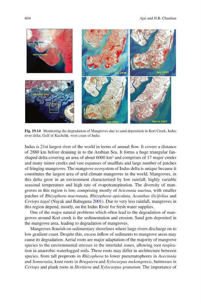
One of the major natural problems which often lead to the degradation of mangroves around Kori creek is the sedimentation and erosion. Sand gets deposited in
the mangrove area, leading to degradation of mangroves.
Mangroves flourish on sedimentary shorelines where large rivers discharge on to
low gradient coast. Despite this, excess inflow of sediments to mangrove areas may
cause its degradation. Aerial roots are major adaptation of the majority of mangrove
species to the environmental stresses in the intertidal zones, allowing root respiration in anaerobic waterlogged soils. These roots may differ in architecture between
species, from tall proproots in Rhizophora to lower pneumatophores in Avecinnia
and Sonneratia, knee roots in Bruguiera and Xylocarpus mekongensis, buttresses in
Ceriops and plank roots in Heritiera and Xylocarpus granatum. The importance of
Fig. 19.14 Monitoring the degradation of Mangroves due to sand deposition in Kori Creek, Indus
river delta, Gulf of Kachchh, west coast of India
Ajai and H.B. Chauhan