

595
2000). Kanniah et al. (2015) have monitored mangrove status change over a period
of 25 years in Iskandar Malaysia using Landsat- TM, ETM and OLI (Operational
Land Imager) data. Giri et al. (2007) have used multi-temporal satellite data of
1973–2000 to monitor the status of mangroves of Sunderbans in Bangladesh and
India. Aizpuru et al. (2000) have carried out global assessment of the cover change
of mangrove forest using satellite images at medium to high resolutions. Reddy
et al. (2007) have used remote sensing and GIS to monitor mangroves of Bhitarkanika
wild life sanctuary, Odhisa state, east coast, India. Mangrove regeneration has been
monitored using multi- spectral IRS- LISS III data in Gulf of Kachchh, Gujarat state
in western India by Upadhyay et al. (2015).
Monitoring is done by acquiring EO satellite data of desired spatial resolutions
at the required interval of time. Multi-date images are geo-referenced and coregistered to find out the spatial changes occurring in a particular landcover or landuse class. Details of the methodology for processing and analysis of multi-temporal
satellite data for monitoring of mangrove forest is given in Fig. 19.8. Multi date
satellite data are subjected to radiometric normalization and geometric correction.
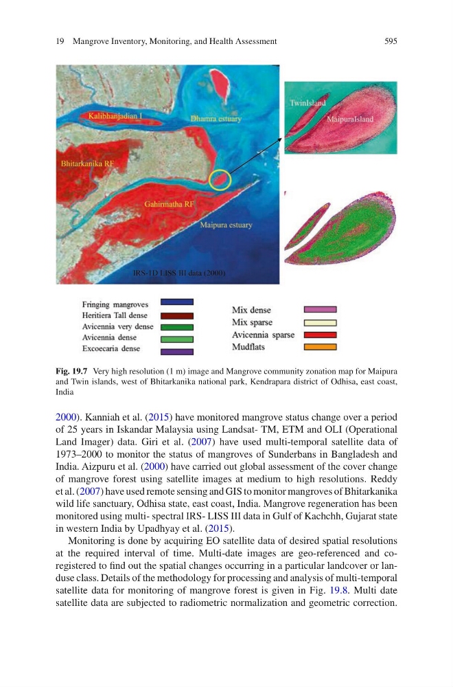
Fig. 19.7 Very high resolution (1 m) image and Mangrove community zonation map for Maipura
and Twin islands, west of Bhitarkanika national park, Kendrapara district of Odhisa, east coast,
India
19 Mangrove Inventory, Monitoring, and Health Assessment