

581
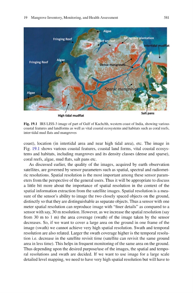
coast), location (in intertidal area and near high tidal area), etc. The image in
Fig. 19.1 shows various coastal features, coastal land forms, vital coastal ecosystems and habitats, including mangroves and its density classes (dense and sparse),
coral reefs, algae, mud flats, salt pans etc.
As discussed earlier, the quality of the images, acquired by earth observation
satellites, are governed by sensor parameters such as spatial, spectral and radiometric resolutions. Spatial resolution is the most important among these sensor parameters from the perspective of the general users. Thus it will be appropriate to discuss
a little bit more about the importance of spatial resolution in the context of the
spatial information extraction from the satellite images. Spatial resolution is a measure of the sensor’s ability to image the two closely spaced objects on the ground,
distinctly so that they are distinguishable as separate objects. Thus a sensor with one
meter spatial resolution can reproduce image with “finer details” as compared to a
sensor with say, 30 m resolution. However, as we increase the spatial resolution (say
from 30 m to 1 m) the area coverage (swath) of the image taken by the sensor
decreases. So, if we want to cover a large area on the ground in one frame of the
image (swath) we cannot achieve very high spatial resolution. Swath and temporal
resolution are also related. Larger the swath coverage higher is the temporal resolution i.e. decrease in the satellite revisit time (satellite can revisit the same ground
area in less time). This helps in frequent monitoring of the same area on the ground.
Thus depending upon the desired purpose/use of the images, the spatial and temporal resolutions and swath are decided. If we want to use image for a large scale
detailed level mapping, we need to have very high spatial resolution but will have to
Fig. 19.1 IRS LISS-3 image of part of Gulf of Kachchh, western coast of India, showing various
coastal features and landforms as well as vital coastal ecosystems and habitats such as coral reefs,
inter-tidal mud flats and mangroves
19 Mangrove Inventory, Monitoring, and Health Assessment